
Another rain and wind storm forecast to arrive Monday in the Maritimes
For the second week in a row, the Maritimes will start the work week with a rain and wind storm moving into the region.
The storm will develop in the Gulf Of Mexico on Saturday before tracking across Florida and then up the Eastern Seaboard throughout Sunday and into Monday.
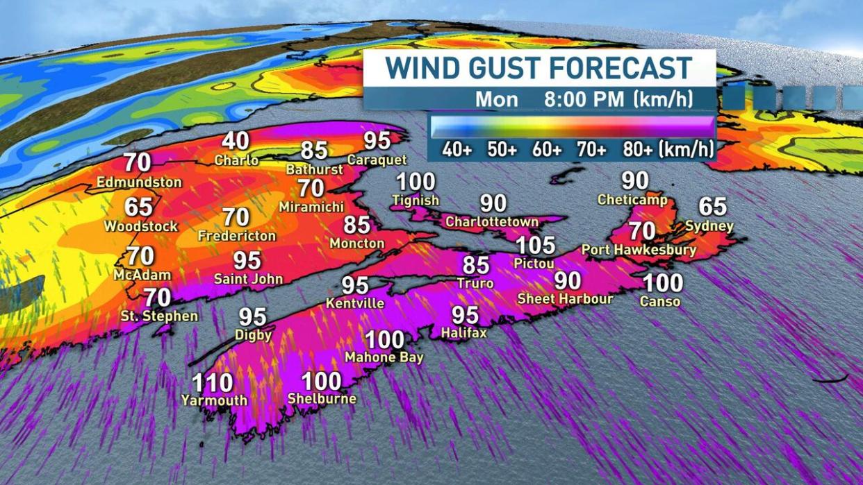
The rain and wind from the storm will track in from west to east throughout the day on Monday with the heaviest bands of rain and strongest winds set to arrive Monday afternoon, evening and overnight.

The heaviest bands of rain and strongest winds are expected Monday afternoon, evening and overnight. (Ryan Snoddon/CBC)
Widespread strong southerly winds gusting to between 80 km/h and 100 km/h are possible for most of the region, with gusts exceeding 100 km/h possible for coastal and exposed areas of Nova Scotia, New Brunswick and P.E.I.
Much like this past Monday, folks should prepare for some power outages due to the strong winds.
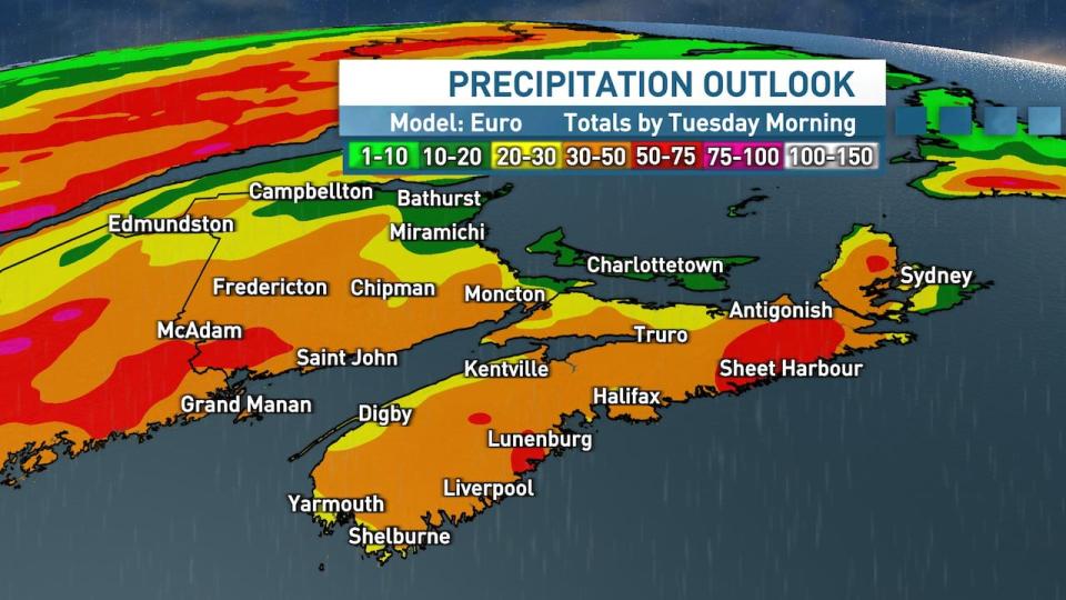
Widespread rain could total 25-50 millimetres by Tuesday morning with some areas receiving as much as 75millimetres. (Ryan Snoddon/CBC)
Holiday decorations should also be secured yet again.
At the moment, a widespread 25-50 millimetres of rain is most likely to fall by Tuesday morning, however with downpours of moisture streaming in from the south, some pockets of heavier rain in the 50-75 millimetre range are also possible.
Locations where heavier rain is predicted will become more clear throughout the weekend, however the Atlantic coastline of Nova Scotia, the eastern mainland, Cape Breton, as well as southwestern New Brunswick could all see rainfall amounts exceeding 50 millimetres.
Uncertainty remains beyond that, however additional heavier bands of rain and gusty winds may linger throughout Tuesday and into Wednesday for eastern areas.
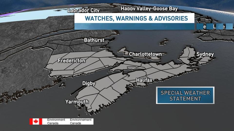
Environment and Climate Change Canada has issued special weather statements for the region advising residents to prepare for strong winds, rain and pounding surf. (Environment Canada)
Storm drains, downspouts and sump pumps should all be checked over the weekend to make sure the water on your property has an exit route.
Environment and Climate Change Canada has already issued special weather statements for the province to prepare for strong winds, rain and high waves. Warnings are likely to be issued on Sunday, so stay tuned for updates.
MORE TOP STORIES

