
Daily threat of powerful thunderstorms with hail, heavy rain in central, eastern US


As the sweltering heat continues to bake the Midwest and Northeast this week, AccuWeather forecasters say a separate daily hazard will arise on the northern edge of the heat: severe thunderstorms.
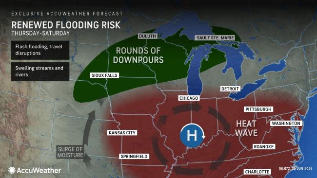
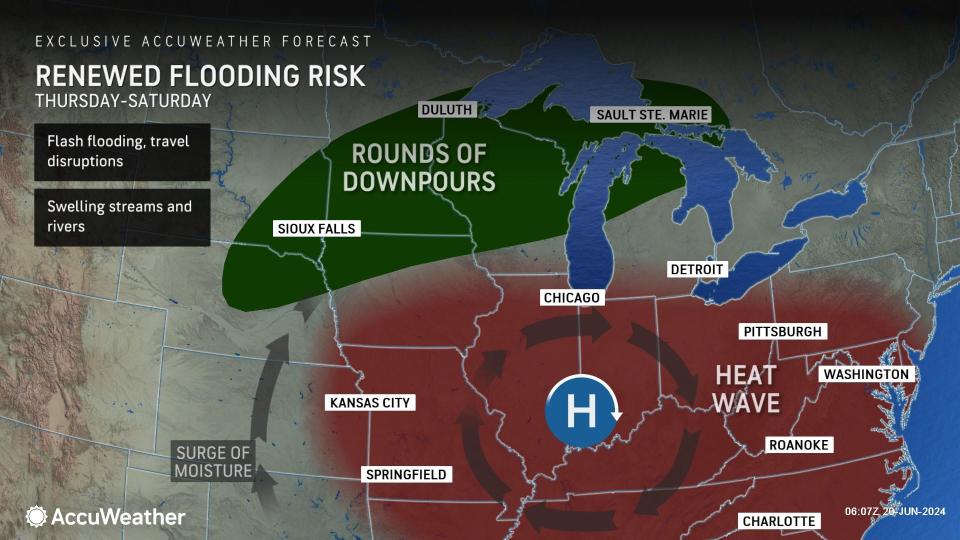
Across the Plains, a low pressure system advancing along a slow-moving cold front will help to spark rounds of thunderstorms, heavy rain and hail. By Thursday, the front will shift into the interior Northeast, producing flooding downpours and hail as thunderstorms occur along the northern periphery of the heat.
 |
As the front advances eastward across the nation, storms will shift into the upper Ohio Valley and Northeast. Wind gusts within the strongest storms from Thursday to Thursday evening can reach speeds of 50 to 60 mph with the AccuWeather Local StormMax™ of 70 mph.
Thunderstorms tracking into the Northeast will not only bring pockets of intermittent downpours and an uptick in moisture, they will also help bring some relief from the intense heat for some.
 |
Locations such as Albany and Syracuse, New York, are projected to drop from the upper 90s Fahrenheit early this week to the middle to upper 80s F by late week.
By Friday and Friday evening, thunderstorms will progress along the front into southern New England and a portion of the I-95 corridor. Travel disruptions can occur within downpours and commuters are urged to remain weather aware.
 |
Forecasters say sporadic storms are expected to persist into the start of the weekend across the Ohio Valley and Northeast. These storms may alter outdoor plans.
Severe weather is not expected in the Northeast this weekend.
Want next-level safety, ad-free? Unlock advanced, hyperlocal severe weather alerts when you subscribe to Premium+ on the AccuWeather app. AccuWeather Alerts™ are prompted by our expert meteorologists who monitor and analyze dangerous weather risks 24/7 to keep you and your family safer.
