
Dangerous spring storms threaten millions in US
A band of unseasonable spring storms is set to dump snow on much of the upper Midwest and Northeast and bring a significant threat of tornadoes to the Ohio River and Mississippi River valleys starting Tuesday, putting millions of Americans at risk of severe weather.
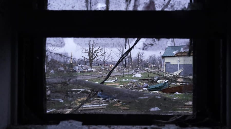
The National Weather Service (NWS) declared a level 4 out of 5 risk of severe storms over much of Ohio, Kentucky and Tennessee on Tuesday, warning of high winds and the risk of hail and tornadoes.
The most severe risk is along the Ohio River valley between Cincinnati and Louisville, the agency said. Storms in the region began Monday evening and are anticipated to continue throughout the day.
“The hazards associated with these thunderstorms are frequent lightning, severe thunderstorm wind gusts, hail, and a few tornadoes,” the NWS said early Tuesday. “In addition, there is an increased threat of EF2 to EF5 tornados over parts of the Ohio/Tennessee/Lower Mississippi Valleys.”
Ohio’s tornado risk is the highest in 10 years, the NWS Storm Prediction Center warned, with multiple tornadoes possible throughout Tuesday. Weaker tornadoes are also possible further south toward Tennessee and northern parts of Alabama and Georgia.
11:56am CDT #SPC Public Severe Weather Outlook #PWO concerning #alwx #gawx #ilwx #inwx #kywx #mswx #ohwx #tnwx #vawx #wvwx https://t.co/fhmKCoRsY6 pic.twitter.com/KgnRKDvHlq
— NWS Storm Prediction Center (@NWSSPC) April 2, 2024
The same weather system already spawned three tornadoes in Oklahoma and massive hail in Texas on Monday.
The northern edge of the storm front is expected to bring snow to the upper Midwest on Tuesday, tracking east across the Great Lakes and into New England by Friday. The Twin Cities saw light snow, with Chicago also expected to get flurries.
Significant snowfall is also anticipated for Upstate New York and much of New England, the NWS predicted, alongside heavy winds. The Adirondacks could see a foot of snow Thursday.
The agency warned residents to limit travel when possible, noting a 60 percent to 70 percent change of hazardous travel conditions and low visibility.
For the latest news, weather, sports, and streaming video, head to The Hill.

