
Wildfire risks in California heightened by upcoming heat dome
Another bout of dangerous, triple-digit heat is headed for much of California's interior this weekend, creating new concerns for firefighters battling wildfires across the state, including two that have surpassed 15,000 acres.
"Friday will kick off a fairly dramatic warm-up as a large and hot upper-high over the middle of the [country] expands westward," the National Weather Service wrote in its Wednesday morning forecast. The upper-level ridge of high pressure — known colloquially as a heat dome — will most directly affect the San Joaquin Valley and Southern California deserts, but almost all of the Golden State can expect elevated temperatures this weekend.
The Los Angeles area will remain on the western edge of the system as it moves across the Southwest before expanding north and west — creating significant "compressional heating" below the ridge of high pressure, said Joe Sirard, a weather service meteorologist in Oxnard. Sirard said "heat dome" isn't a precise meteorological term, but describes the process that pushes temperatures up as air sinks below the upper ridge.
“That will help to build the heat," Sirard said. "The hottest weather should be in the deserts, the San Joaquin Valley and inland valleys — away from the coast."
Much of interior California is expected to see moderate or major heat risks Friday, Saturday and Sunday, and in some areas through at least Tuesday. The San Joaquin Valley and Sierra Nevada foothills are expecting "dangerously hot conditions," with an excessive heat watch going into effect Saturday through at least Monday, when temperatures up to 110 degrees are possible.
In the Southland, Saturday is expected to be the warmest day, when highs in Los Angeles County valleys will reach into the 90s while the deserts and low mountains will peak near 105 degrees.
It will be "a few degrees above normal for the most part through Wednesday next week,” Sirard said. The coasts, however, will be largely unaffected, as the upper ridge remains farther east, and the system could actually strengthen the marine layer through the weekend.
The soaring temperatures are already on firefighters' radar, as they will come just days after severe winds fueled the flames of the Post fire, which started Saturday near Gorman in northern L.A. County and quickly exploded in size.
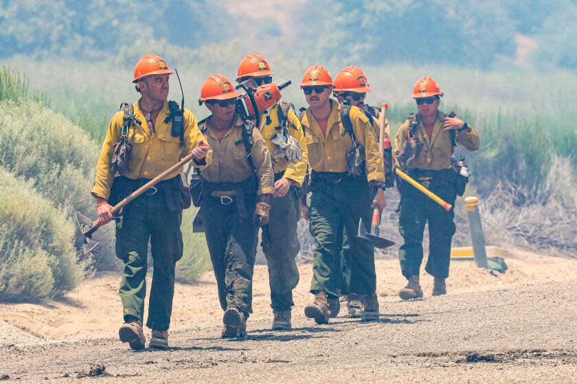
“Any time the weather heats up, … obviously it’s going to be a driving force for the spread of the fire," said Jonathan Torres, a Los Angeles County Fire Department spokesperson. "Obviously it makes it a lot harder for the hand crews."
Read more: How is climate change affecting heat waves in California and the West?
As of Wednesday morning, the Post fire was 39% contained and appeared to be holding at 15,690 acres, according to fire officials. After days of treacherous red-flag conditions — gusty winds and low humidity — firefighters were able to make "significant progress" Tuesday night, according to a Wednesday morning update.
"Weather conditions last night were favorable and allowed crews to increase containment lines," the update said, noting that a "significant warming trend" is expected to begin Thursday through the weekend. Winds were expected to reach 20 mph Wednesday, far from insignificant, but dramatically weaker than what crews had faced the last few days.
Due to the treacherous conditions and steep terrain, fire officials continued to shuttle crews by boat across Lake Pyramid to more directly access the flames Wednesday while air crews continued to work from above.
Read more: Heat wave or heat dome? Yes, there's a difference
In northern Colusa County, the Sites fire had grown to 15,565 acres by Wednesday morning, almost catching up in size to the Post fire, which recently became the state's largest wildfire of the year. The Sites fire was only 5% contained, according to the California Department of Forestry and Fire Protection.
Fire officials there were hoping to make significant progress Wednesday and Thursday — during a reprieve between severe winds that have mostly subsided and high temperatures on the horizon.
"It's going to get pretty hot this weekend, over 100 degrees probably for about a four- or five-day stretch," Cal Fire's Sonoma-Lake-Napa Unit chief Mark Marcucci told crews at the Sites fire morning briefing. "So what I'm asking you today is continue that good work, and let's see what we can get done so we can minimize the amount of folks we need to have out there over the weekend."
Communities near both the Post and Sites fires remained under evacuation orders, with dozens of buildings still threatened.
Across the state, there were at least two other major wildfires still active: the Point fire in Sonoma County, which was 50% contained Wednesday and had burned 1,207 acres, and the Aero fire in Calaveras County, which grew to 5,425 acres Wednesday and was 33% contained, according to Cal Fire.
This story originally appeared in Los Angeles Times.

