
Heavy rain, high winds expected Wednesday for most of N.B., before rapid temperature drop
Heavy rain and strong winds are expected to hit New Brunswick on Wednesday, with a big drop in temperature to follow.
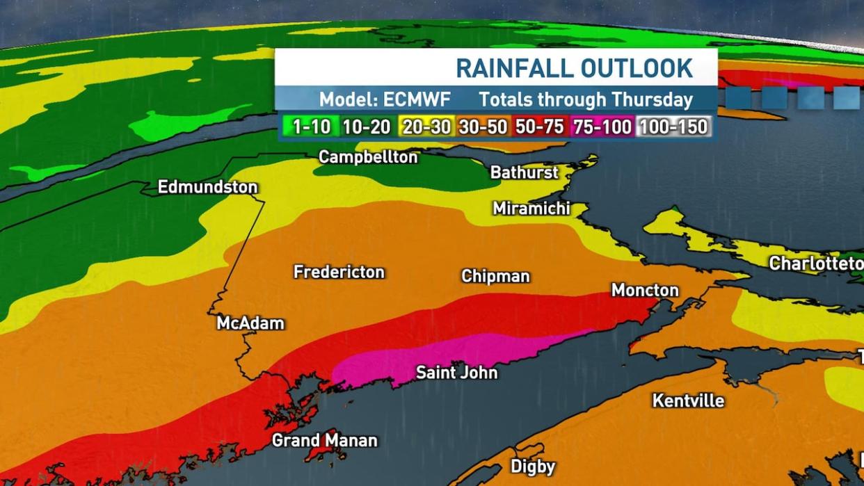
A warning from Environment Canada says southern regions could see 70 to 100 millimetres of rain, with potentially higher amounts along the Fundy coast. Central and eastern New Brunswick are expected to see 30 to 60 millimetres.
Because the ground is frozen, it has a reduced ability to absorb rain, the warning said. The milder temperatures at this time, to 10 or 11 C in some places, will also lead to "considerable snowmelt."
The storm will go from Wednesday morning until Thursday morning, but Environment Canada meteorologist Jill Maepea said the heaviest rain won't be until mid-afternoon Wednesday.
On Thursday morning, temperatures are supposed to quickly drop below the freezing mark, making for potentially difficult driving conditions.
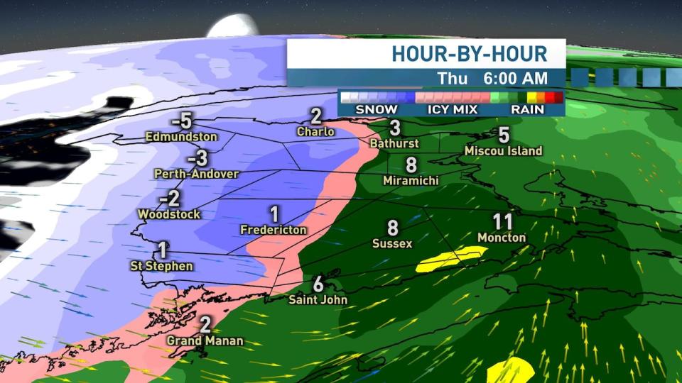
On Thursday morning, temperatures are expected to drop below freezing. (Ryan Snoddon/CBC)
According to Environment Canada, the storm could cause erosion to road shoulders and washouts.
The City of Saint John put out a news release asking residents to clear catch basins and gutters, exercise caution around coastal areas, reduce driving speed and avoid driving through areas covered in water.

