
Many heat records likely Tuesday in a 'staggering departure' from the norm

UPDATE | Tuesday's daily heat records include Belleville, Kemptville, Maniwaki and 19.4 C in Cornwall.
Ottawa hit 11.9 C, short of its record.
Well, if Wiarton Willie, Shubenacadie Sam and Fred la Marmotte could speak, they'd probably be saying "I told you so."
The furry critters saw no shadows Feb. 2, seen as a call for an early spring — but one wonders if they knew it would be this warm.
Forecasters expect daily heat records in more than a dozen communities across eastern Ontario and western Quebec Tuesday.
Belleville, Kemptville and Picton have set new daily records as of 1 p.m., for example.
Otttawa's forecasted high of 16 C would not only set a daily heat record, but a February one: 12.4 C this same date in 2000.
16 C is close to the city's average high in May, let alone March.
"Typically we see temperatures around – 2 C as our daytime highs in Ottawa this time of year," said Environment Canada and Climate Change warning preparedness meteorologist Trudy Kidd, calling the forecast "a staggering departure."
Ottawa's Feb. 28 record high is 9.9 C set in 2018 and will likely be topped as well, said Kidd. The city's hottest winter day on record is likely going to stay as 25.1 C back on March 18. 2012.
The hottest October day in Ottawa's records happened last year.
These records go back to the 1870s.
28-degree change
The jarring swings don't end there: the temperature will likely take a deep plunge Wednesday evening and Thursday.
Ottawa's forecasted Wednesday high is 13 C with showers and a risk of a thunderstorm. The overnight low could be –15 C with snow.
Environment Canada has a weather advisory for western Quebec about the low pressure system melting snow with heat and rain, followed by a "vigorous cold front" Wednesday afternoon and night to freeze that water.
Another mini spring-like heat wave with highs roughly around 6 or 7 C should kick off the first weekend of March, according to the Environment Canada forecast.
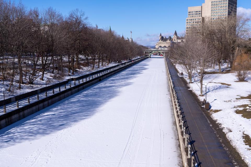
The Rideau Canal Skateway looking north from the Corktown Footbridge on Monday, the day after the skateway as a whole closed for the season. This stretch never opened. (Francis Ferland/CBC)
If the longer range models are to be believed, don't expect seasonal temperatures any time soon, either.
"The next few weeks are sure to be higher than normal in terms of temperature and likely wetter than normal as well," said Kidd.
The outlook for the remainder of springtime is also looking unseasonably mild, but it's not clear by how much, she said.
The experts at Environment Canada suggest a balmy mix of climate change and El Niño are to blame for the extraordinarily mild winter which saw the Rideau Canal Skateway opening for a sporadic ten days in total.
"My climatologist friend said a strong El Niño heavily loaded the dice toward the conditions we've been experiencing," said Kidd.
While some might welcome the sun and warmth, Kidd suggests it can be a source of stress and anxiety for people who are concerned about climate change and suggests people reach out to a professional or seek online resources.
The federal government and the Centre For Addiction and Mental Health web sites are good places to start.

