
More severe thunderstorms to prowl the central US


Severe weather is forecast for multiple days in several locations in the central United States through this week, and at least one area in the Midwest has the potential to travel hundreds of miles while producing damaging wind gusts, AccuWeather meteorologists warn.
Overall, the setup for tornadoes this week is not as volatile as it was during much of May in the Central states. However, severe thunderstorms can occasionally produce tornadoes. In the absence of any twisters, powerful wind gusts, hail and flash flooding will still threaten lives and property. The severe weather threat will extend from Mexico northward to near the Canada border at times.
Into Wednesday night, the main threat of severe weather jumped northward once again, AccuWeather Meteorologist Brandon Buckingham said. Many of the severe reports came from Minnesota.
 |
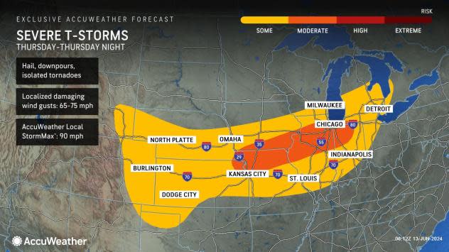
On Thursday, the threat of severe storms, many packing high winds, will extend from southern Michigan and northern Ohio to eastern Colorado and southeastern Wyoming. However, the extent and position of this severe weather zone will depend on the travels of the severe thunderstorms from the night before, as well as the forward speed of the front itself.
The major Midwest airport hubs of Chicago, Detroit and St. Louis may be affected on Thursday. As the storms approach and roll through the airports' airspace, ground stops may be issued by the Federal Aviation Administration (FAA), and airline delays and flight cancellations may mount.
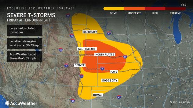
On Friday, thunderstorms will likely erupt in parts of the Northeast. At the very least, a few of these storms will become severe with powerful wind gusts.
 |
"By the time the front reaches the Great Lakes and Northeast later this week, it may have little moisture to work with," AccuWeather Senior Meteorologist Dave Dombek said.
Since the influx of Gulf of Mexico moisture may be blocked by a zone of high pressure extending from the lower Mississippi Valley to the Carolina coast from Thursday to Friday, many of the severe thunderstorms to the north may bring only brief downpours and perhaps little to no rain at all in some communities, Dombek explained.
 |
More severe storms are forecast to erupt farther to the west over parts of the High Plains late Friday as well.
Large hail and high wind gusts are the main threats on Friday. However, the strongest storms could spawn a few tornadoes.
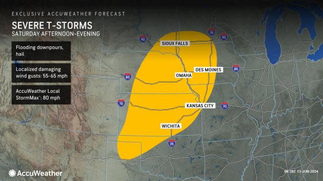
Severe thunderstorms are expected to rumble in two separate zones on Saturday. One will be from southeastern South Dakota and southwestern Minnesota to the panhandle of Texas.
 |
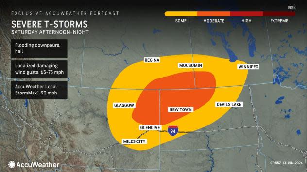
The other zone is likely to be located from northeastern Montana into northwestern North Dakota and southern Canada; of the two severe areas on Saturday, this one may be more intense.
 |
 |
"Heading into the summer season, an atmospheric setup like this can pose a risk for the development of powerful, long-lasting squall lines [derechos], which can pack powerful straight-line wind gusts over a broad area," Buckingham said.
Want next-level safety, ad-free? Unlock advanced, hyperlocal severe weather alerts when you subscribe to Premium+ on the AccuWeather app. AccuWeather Alerts™ are prompted by our expert meteorologists who monitor and analyze dangerous weather risks 24/7 to keep you and your family safer.
