
Showery chaos to keep heat waves at bay across Northeast for now

As unseasonably cool air descends upon the Northeast early this week, the atmosphere will respond with pop-up showers and thundershowers. AccuWeather meteorologists say that conditions later this week may be a tug-of-war between a dry and rainy pattern, and there might be hints of the season's first heat wave in the cards in the long range.
The weekend kicked off with relatively nice conditions for those enjoying outdoor activities, especially in the mid-Atlantic and southern New England. By the end of the weekend, however, a reinforcing pocket of chilly air dropped down into the Northeast, resulting in cooler conditions that will hang around into early week.
"Much of the Northeast took in a bonus day Saturday, as a pocket of dry air moved in with warmer air aloft," AccuWeather Senior Meteorologist Dave Dombek said, "That warm and dry pocket resulted in seasonable temperatures and a rain-free day for many."
 |
This follows a somewhat chaotic day on Friday with pop-up showers, mainly over the interior Northeast.
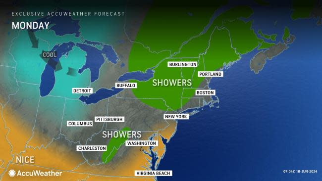
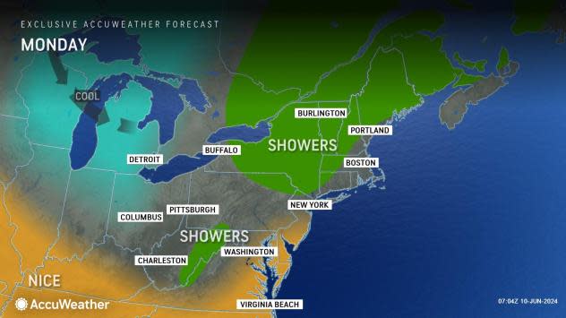
"The weather may be a little annoying for those with outdoor plans in parts of the Northeast [into Monday]," AccuWeather On-Air Meteorologist Ariella Scalese said, "A shower will pass through; it's dry for a bit, then it showers again."
The time between the showers will vary from minutes to hours. Likewise, some of the showers will only last for a few minutes while it may rain more often than not for several hours in other areas.
A couple of disturbances will add to the mosaic of showers, enhancing the activity as they approach and decreasing or shutting down the downpours for a time after they move by. Shower coverage increased as Sunday progressed then will decrease again on Monday.
 |
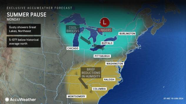
Temperatures will rise back to within a few degrees of the historical average along the Interstate 95 corridor into early this week. However, temperatures will run 5-10 degrees Fahrenheit below the historical average farther inland during the same period. This means that highs over most mountainous areas will be in the 60s. Near the coast, highs will generally range from the mid-70s to the lower 80s.
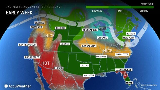
Looking ahead, the forecast from Wednesday to Saturday will depend on the movement of a disturbance in the Central states.
"If that disturbance drops southeastward and quickly turns eastward, conditions will deteriorate in the form of clouds, areas of drenching rain and thunderstorms for much of the Eastern states," AccuWeather Senior Meteorologist Bob Smerbeck said.
 |
"On the other hand, if that disturbance is much slower in turning eastward, then much of the East may have a string of sunny and dry days with a warming trend," Smerbeck explained.
At this time, it appears that much of the region will be dry from Tuesday to Wednesday; after that is when downpours may return or slide to the south.
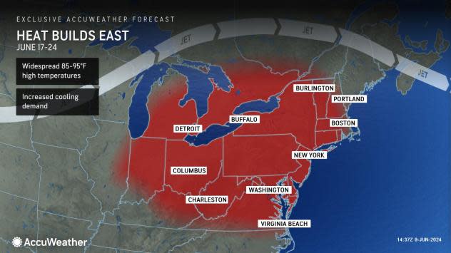
Looking ahead to the second half of June, indications continue to point toward a significant warmup in the Northeast. However, any tropical activity in the Gulf of Mexico or along the southern Atlantic coast may play a role in the weather patterns to the north.
The jet stream will likely bulge northward in the region, much like it has done in the West this past week. When this occurs, it promotes warmer weather over a large area.
 |
"Parts of the Northeast may have their first heat wave of the summer during the week of June 17," AccuWeather Long-Range Meteorologist Brandon Buckingham said.
The heat may set up first over the northern tier of the Northeast before expanding southward. Widespread highs ranging from 85 to 95 degrees Fahrenheit are likely over multiple days.
The National Weather Service defines a heat wave as abnormally hot weather, with or without high humidity, generally lasting more than two days. In the Northeast, the 90-degree mark is the unofficial threshold for hot weather in most locations.
Competing factors for this event will be the extent of cooling sea breezes versus offshore winds in the coastal Northeast and how dry the ground gets beforehand. A stiff offshore breeze can prevent a cooling sea breeze, and dry ground can heat up much faster than a moist landscape.
Want next-level safety, ad-free? Unlock advanced, hyperlocal severe weather alerts when you subscribe to Premium+ on the AccuWeather app. AccuWeather Alerts™ are prompted by our expert meteorologists who monitor and analyze dangerous weather risks 24/7 to keep you and your family safer.
