
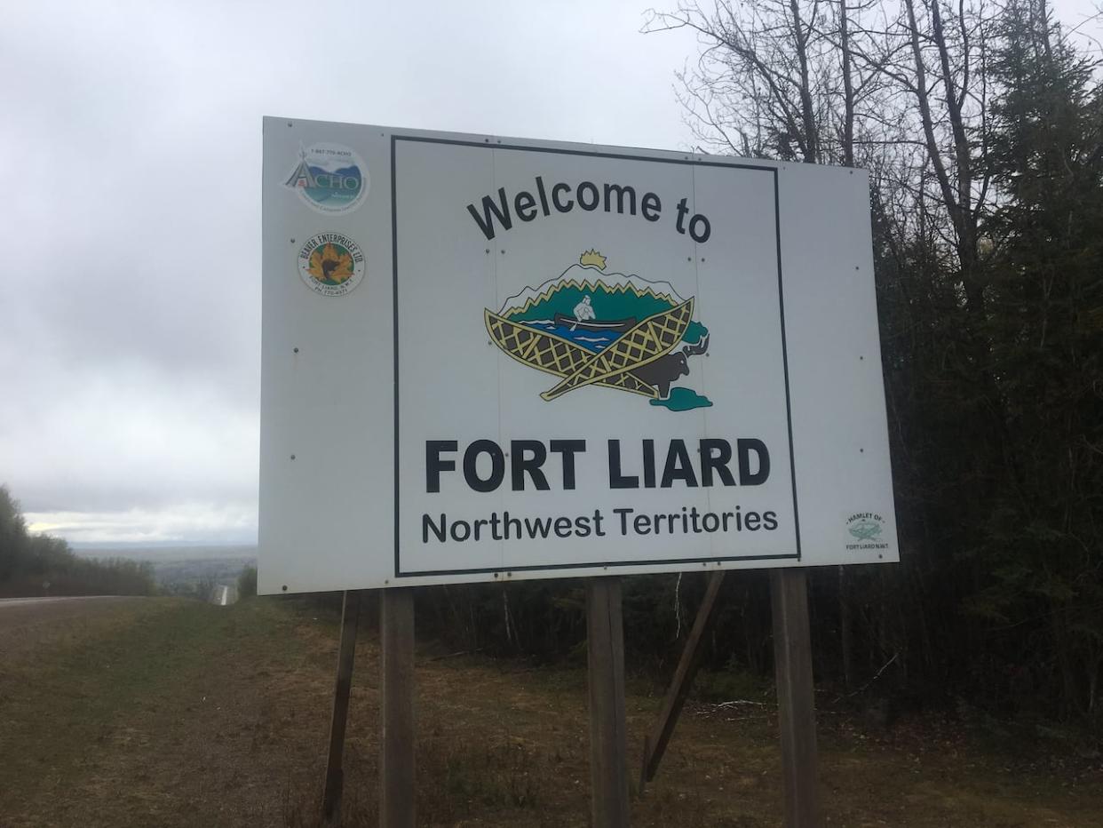
'Risk has risen' in Fort Liard, N.W.T., after wildfire crosses river west of community
What you need to know about the N.W.T. wildfires as of 7:00p.m. Friday:
Evacuation notice put out for Fort Liard, telling residents to prepare in case they need to evacuate
N.W.T. Fire says fire has crossed Liard River, increasing risk to Fort Liard
High winds preventing firefighting aircraft from taking off
Highway 7 closed due to B.C. wildfires
Highway 35 in northern Alberta closed due to fire near N.W.T. border
Highway 1 closed due to wildfire between Jean Marie River access road and Highway 3 junction
A wildfire burning west of Fort Liard, N.W.T., jumped the Liard River on Friday evening, posing a greater threat to the community that's under an evacuation notice.
"Risk has risen to the community of Fort Liard," reads an update from fire officials, issued just before 6:30 p.m. MT.
Fire information officer Mike Westwick said the river was a natural fuel break that the fire has now breached.
"That puts it on the same side of the river as Fort Liard," he said, early Friday evening.
"It's classified as out of control, it is uncontained, it is growing, and we are not able to suppress that growth directly at this time due to the safety conditions."
The fire had been burning to the west of Fort Liard and the Liard River earlier on Friday. Strong winds from the west through the day pushed the fire eastward, and across the river, Westwick said.
As of Friday evening, firefighters were unable to directly attack the fire because of unsafe conditions. Westwick said high winds and poor visibility meant that firefighting aircraft couldn't be used.
It was also hard to say how far the fire was from the community, he said.
"There's no road access, we can't fly. So we don't have an exact location," he said.
An evacuation notice was issued earlier Friday afternoon for Fort Liard as the wildfire was then burning about 22 kilometres away.
Westwick said fire crews are in Fort Liard, setting up sprinklers and focusing on "critical infrastructure" and protecting the perimeter of the community.
Fort Liard under evacuation notice
The evacuation notice posted earlier Friday on the N.W.T.'s public safety website said residents should keep vehicles fuelled and prepare an emergency kit.
"It's a notice to just be prepared," said John McKee, Fort Liard's SAO.
"You can't wait until the last minute."
McKee said a lot of people in the community have cleared brush from their properties, and the hamlet has done the same around different municipal buildings.
McKee said in the case of an evacuation order, the destination for residents would be determined by highway conditions. He said as of Friday, it wouldn't be in B.C. because of the closure or Highway 7.
Highway 35 was also closed late Friday afternoon, just south of the Alberta/N.W.T. border.
Sean Whelly, mayor of Fort Simpson, told CBC News the community is listed as the evacuation centre in case Fort Liard residents are told to leave.
An evacuation notice is the first of three levels of emergency. The second would be an evacuation alert and the final is an evacuation order.
The hamlet of Fort Liard said on its website that a fire ban was implemented on Thursday and it also posted a list of necessities in the case of an evacuation.
Highway 7 closed
Two separate active wildfires have closed Highway 7 at the N.W.T./B.C. border, the territory's Department of Infrastructure said on Friday.
The department said residents and travellers should know that conditions in the area can change with little to no warning, and that they should expect smoky conditions and poor visibility in the area.
Residents should also stay out of the bush in the areas surrounding Highway 7.
"High winds are expected to continue through this region. Under these conditions, there is a high chance of tree fall - which is a serious danger to those on the land," the update said.
An evacuation alert has also been issued by the Northern Rockies Regional Municipality for the area stretching from southeast to the northwest of Fort Nelson, B.C. That's due to fires located near Nogah Creek and Patry Creek.
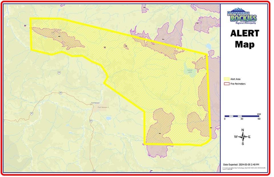
An evacuation alert map that was posted on the Northern Rockies Regional Municipality website. (Northern Rockies Regional Municipality website)
N.W.T. fire officials are also warning that high winds and dry conditions could mean extreme fire activity in the South Slave and Dehcho regions. They said winds could gust from 50 to 85 km/h.
The Town of Hay River posted on Facebook that it was implementing a full-fire ban until after the wind event on Saturday. The town also said that the fire department is responding to an underground fire on Patterson Road, but that it is contained to an area that's been previously burned.
"There is no risk to the public but smoke will be visible," the post reads.
New fire detected east of Sambaa K'e
A holdover fire has also flared up near Sambaa K'e, roughly one kilometre southeast of the community. It is not considered a threat to the community. Winds were expected to push it away from the community, N.W.T. Fire said in an update.
Storms are also in the forecast for numerous areas, including the northern Dehcho and southern Sahtu, increasing the likelihood of lightning-caused fires.
Winds are expected to come from the west around Hay River and Fort Smith, and from west to northwest around Fort Simpson.
The M.V. Lafferty ferry at the Liard River crossing in Fort Simpson was briefly suspended Friday due to high winds.
But Jacqueline Demers, the regional superintendent for the Dehcho region with the Department of Infrastructure, said it reopened around 12:30.
The high winds are expected to end Saturday in most areas, the post reads, with some higher moisture levels returning to the Hay River and Fort Smith areas.
"However, Dehcho is expected to stay very dry and hot with continuing brisk winds," an N.W.T. Fire Facebook post reads.

