
Winter storm warning issued for afternoon, overnight
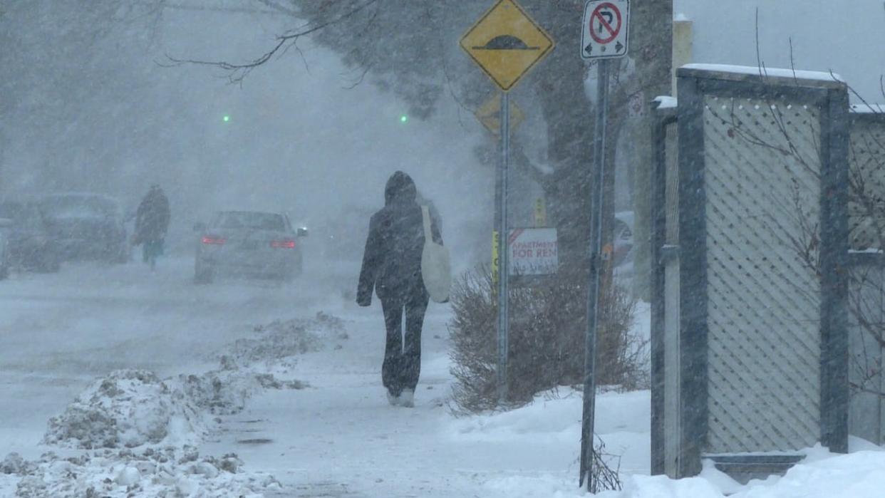
Snow and ice are steadily falling on the Ottawa-Gatineau area Tuesday night, with strong winds and rain also in the cards for some places.
Environment Canada has winter storm warnings in place for most of the region.
The storm is approaching from the south,and the further north you are the more snow you're expected to get.
The warning for Maniwaki and areas west of Gatineau is for 25 to 35 centimetres of blowing snow starting late in the afternoon or early evening and lasting through the night.
For communities east of of Gatineau and ones to its immediate north — almost up to Gracefield — forecasters say to watch out for 20 to 35 centimetres of blowing snow and ice pellets at first.
There may then be a short period of freezing rain overnight before a change to rain in the morning.
In the capital
Snow is falling throughout the Ottawa-Gatineau area, which Environment Canada expects will likely change to ice pellets and freezing rain overnight.
The same is expected for surrounding communities east to Hawkesbury and southwest to Perth.
When that change happens will affect the snowfall total, according to Environment Canada. The best analysis is 10 to 20 centimetres of snow.
Ottawa is forecast to rise from about –5 C at sunset to 0 C by morning and then keep going up to 4 C Wednesday.
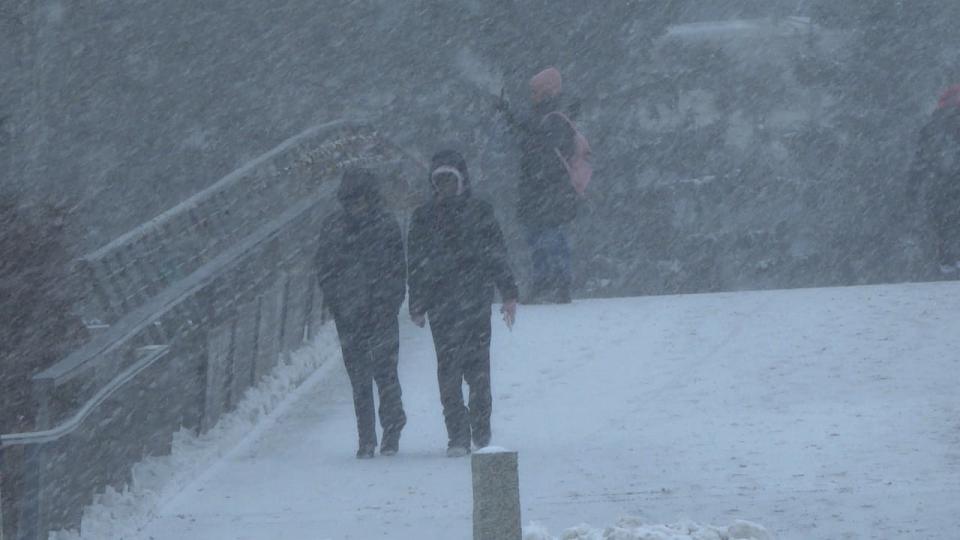
People walk on the Corktown Footbridge in downtown Ottawa on Tuesday. Snow and ice are starting to fall on the Ottawa-Gatineau area this afternoon, with strong winds and rain also in the cards for some places. (Stu Mills/CBC)
There will be a winter parking ban in Ottawa for most drivers on most streets from 10 a.m. to 7 p.m. Wednesday. Gatineau has a winter parking ban starting at midnight when Tuesday becomes Wednesday.
Other areas west of Ottawa such as Pembroke and Bancroft could get it worse than the capital. Their snow range is 15 ot 30 centimetres and they have that risk of wind like neighbours across the Ottawa River.
The Sharbot Lake and Tweed areas are under a snowfall warning. They have a tighter snow window of 15 to 20 centimetres, with a risk of freezing rain as part of a change to rain overnight.
City focuses on clearing roadways
Snow plows were already out on Ottawa's roads late Tuesday afternoon, as city crews prepare for a "very busy" next few days.
Bryden Denyes, an area manager with the city's roads department, said crews are currently plowing and applying salt to priority roads as well as winter cycling routes and priority sidewalks.
"We will be getting into our residential roads, but it'll be probably early, early tomorrow morning," he said.
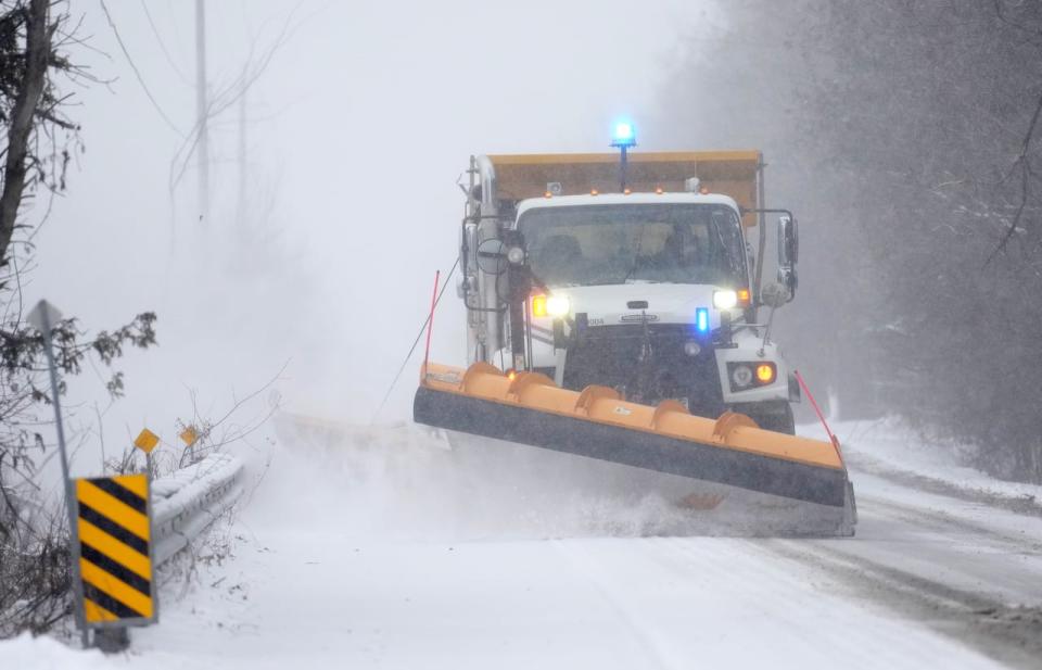
A snow plow clears a section of road in Ottawa on Jan. 9, 2024. City crews are currently plowing roads and applying road salt as snow continues to fall. (Sean Kilpatrick/The Canadian Press)
Priority roads include Highway 174, the Transitway and main roads including Baseline, Carling and Hunt Club, along with their sidewalks.
With a mixed bag of precipitation expected, Denyes said dealing with freezing rain is often the hard part.
"We want to get as much of the heavy wet snow and ice cleared up before we have that freezing temperature," he said.
Rainfall warning for Kingston, Belleville
In Kingston and to the west of the city, there is a rainfall warning about 20 to 35 millimetres of rain starting around sunset. It follows five to 10 centimetres of snow.
There are Environment Canada advisories for those communities close to the St. Lawrence such as Cornwall and Brockville for five to 15 centimetres of snow and a risk of freezing rain. It's also expected to change to rain here.
If you have to travel, check 511 in both Ontario and Quebec and toggle on the options to check road conditions.
English and French school buses are cancelled across eastern Ontario, except for English buses in Ottawa. No changes were announced in western Quebec.
According to CBC's Climate Dashboard, snowfall records are in play Tuesday for Cornwall, Gatineau, Kemptville, Sydenham and Val-des-Monts. Belleville could break a daily rain record.
It had been a drier end to autumn and start to winter than normal.

