
Florida on alert for looming tropical downpours


A new zone that includes waters surrounding Florida will be watched closely by AccuWeather meteorologists for potential tropical development next week.
AccuWeather meteorologists are constantly monitoring the tropical Atlantic for signs of trouble.
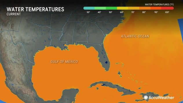
Not every year brings tropical storm formation during June. However, with unusually warm waters currently over many key development areas, the atmosphere over part of the Atlantic basin may behave more like August rather than June. The critical threshold for tropical development is about 80 F, and much of the southwestern Atlantic is already well above that mark.
 |
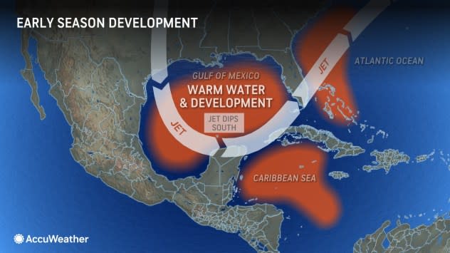
Early-season development tends to hug waters near Central America, the Caribbean and the southern United States. In these areas, surf temperatures are generally highest, disturbances tend to linger and wind shear occasionally drops off.
Wind shear is associated with breezes that are often found in the tropics. When these breezes blow strongly in one direction or change directions at different heights above the sea surface, development may not occur, or an established tropical system could weaken.
 |
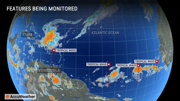
A disturbance responsible for local torrential downpours and gusty thunderstorms in part of the northern Caribbean islands since the weekend will roll out to the northeast and into less favorable development areas of the central Atlantic at midweek.
In the wake of this system, a slight lull in thunderstorm activity is anticipated over the Caribbean, but perhaps it will not be for long.
A series of disturbances known as tropical waves will continue to roll westward from Africa. As these reach the Caribbean, they can lead to a surge in thunderstorm activity. However, they generally need a further boost to evolve into a more potent tropical system.
 |
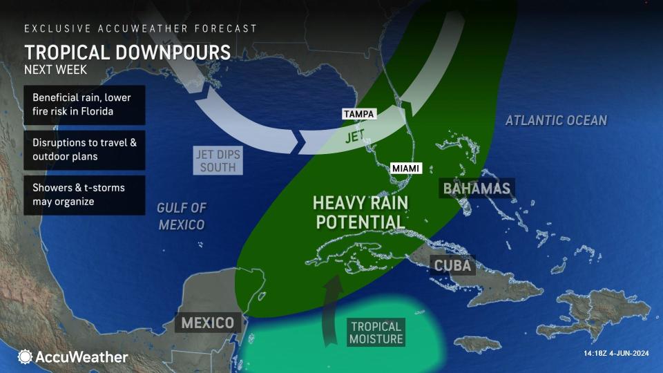
"One feature we are watching will be a dip in the jet stream over the southeastern United States next week," AccuWeather Chief On-Air Meteorologist Bernie Rayno said, "This could provide just enough extra spin and moisture to get something going in the zone from the northwestern Caribbean and the eastern Gulf of Mexico to waters east of Florida toward the middle of next week."
There is an indication that much of this zone will, at the very least, become active for showers and thunderstorms next week as a plume of moisture extends northward.
 |
Whether that disturbance races off to the northeast or gets left behind will depend on the speed of the jet stream dip. If the jet stream lunge is slow to progress, the disturbance will have little time to strengthen and would then be pushed quickly off to the northeast.
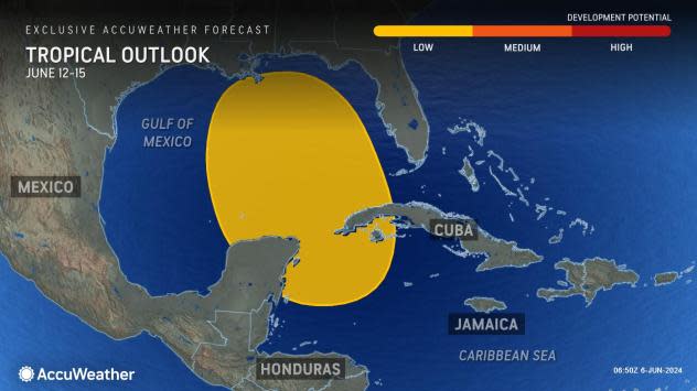
AccuWeather meteorologists have assigned a low risk of tropical development for the zone from the northwestern Caribbean to the central Gulf of Mexico for June 12-15.
 |
However, if the dip leaves quickly, the disturbance may get left behind and could enter the central Gulf of Mexico, where it would have an opportunity to strengthen late next week and be more of a concern for the central Gulf Coast.
Despite a low chance of tropical development at this time, there could be substantial impacts.
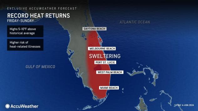
The first will be another surge of heat ahead of the downpours from Friday to Sunday. Temperatures will climb to 5-10 degrees Fahrenheit above the historical average, translating to highs well into the 90s for much of central and southern Florida.
 |
"Downpours produced in the pattern may help to end the abnormally dry and drought conditions and lower the wildfire risk in the central and southern parts of the Florida Peninsula," AccuWeather Lead Long-Range Meteorologist Paul Pastelok said.
Even if a tropical system fails to form, there is the potential for several inches of rain to fall on part of the Sunshine State. At this time, the most likely area for heavy rainfall will be the southern and central counties of the Florida Peninsula. However, there is a chance the moisture surge occurs farther to the north in the Gulf, which might mean more rain farther to the north in Florida.
AccuWeather's Tropical Weather Team, led by Meteorologist Alex DaSilva, continues to sound the alert for an extremely busy hurricane season in the Atlantic with multiple threats for the U.S. Of the 20-25 named systems predicted, eight to 12 are projected to become hurricanes with four to seven to reach Category 3 strength or greater.
These numbers are more than last year and well above the 30-year historical average from 1990 to 2020.
 |
AccuWeather's dozens of meteorologists have hundreds of years of combined forecast experience.
"The same pattern that may bring opportunities for heavy rain to parts of the Florida Peninsula may bring an end to the repeating rounds of downpours and severe weather to portions of the South Central states that have been so prevalent this spring," Pastelok said. "This pattern would tend to cease the flow of moist air from the Gulf of Mexico."
As June progresses, the zone across the northern tier of the Central states could become the new busy zone for thunderstorm activity.
Want next-level safety, ad-free? Unlock advanced, hyperlocal severe weather alerts when you subscribe to Premium+ on the AccuWeather app. AccuWeather Alerts™ are prompted by our expert meteorologists who monitor and analyze dangerous weather risks 24/7 to keep you and your family safer.
