
Storms to erupt on edge of heat dome, dive over Midwest next week


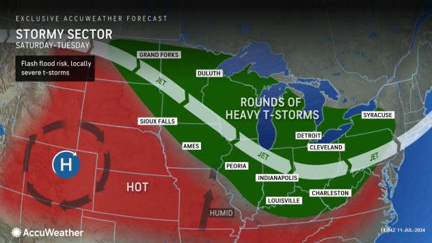
As the core of a massive heat dome shifts toward the Great Plains and lower Mississippi Valley, rounds of storms riding its northern edge will rumble across parts of the Midwest from Sunday to Tuesday and with possibly additional rounds thereafter, AccuWeather meteorologists warn. The storms will bring locally heavy rain and the potential for high wind gusts.
Much of the western United States has been experiencing a major heat wave, which has set all-time record highs in Las Vegas, Palm Springs, Palmdale, and Redding, California, as of Monday. More all-time highs may be set this week before the heat dome shifts farther to the east this weekend and next week.
 |
Multiple days of 100-degree heat are in store for Denver, and highs will approach the century mark by early next week around Kansas City, Missouri.
While few, if any, thunderstorms are likely to occur within the core of high pressure, disturbances riding along the northern rim of the high pressure often lead to thunderstorms.
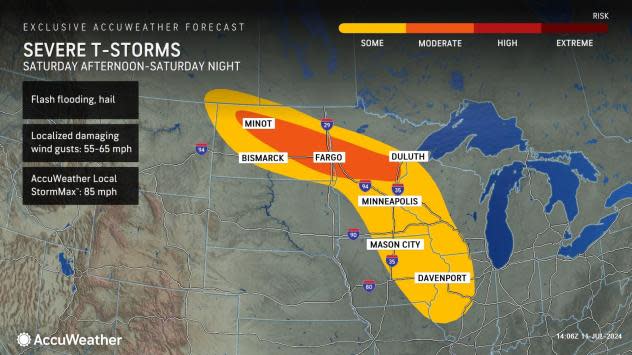
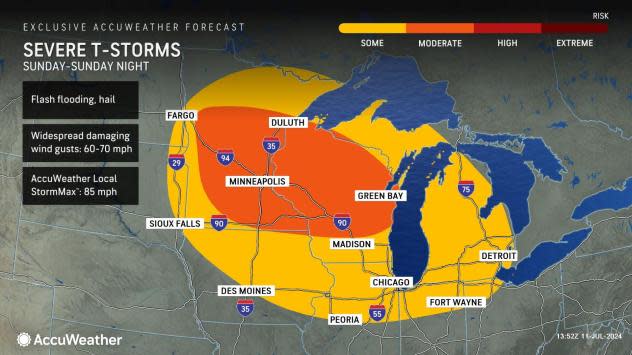
At least one large batch of thunderstorms will erupt over the southern Canadian Prairies and the Dakotas as early as Saturday. From there, the complex of storms may roll for hundreds of miles to the southeast across the northern Plains and into the Great Lakes and Ohio Valley region on Sunday.
 |
While the intensity of this complex and others that may follow from Tuesday to Thursday of next week may vary, they have the potential to be severe with high wind gusts, flash flooding and frequent lightning strikes. Hail may accompany some of the tallest thunderstorms, and a few may even trigger tornadoes.
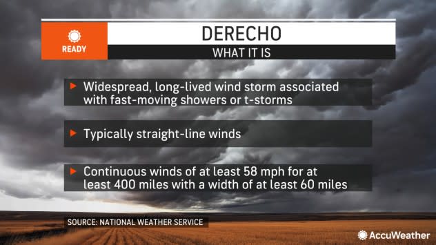
In rare cases, some thunderstorm complexes can evolve into a derecho. These most violent thunderstorm complexes produce wind gusts of 58 mph or greater nearly continuously for at least 400 miles. In the past, such as on Aug. 10-20, 2020, in the Midwest, derechos can lead to considerable property, tree and crop damage.
 |
In most cases, a derecho is not officially declared until the system has already covered the distance and most of the wind incidents have been verified. AccuWeather's long-range team of meteorologists warned earlier this year of the potential for long-lived thunderstorm complexes in the Central states during the middle part of the summer.
Regardless of whether a derecho occurs, by next week, rounds of gusty, drenching and potentially severe thunderstorms will dive from near the Canada border in the Central states to the Great Lakes, middle Mississippi and Ohio valleys.
 |
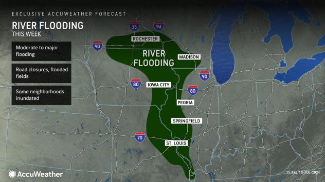
If rain repeats and overlaps Beryl's track from Tuesday, the stakes may be higher for stream and river flooding. A surge of high water associated with excessive rainfall in the spring was slowly working downstream on the Mississippi. Still, some of the secondary rivers in the region may be most prone to new rises should the rain repeat next week.
 |
The same jet stream pattern that extends from central and western Canada and into the central U.S. may carry smoke from Canada wildfires southeastward. In most cases, the smoke will be high-flying and appear as a hazy sky. However, it is possible that on a few occasions, depending on atmospheric conditions, some smoke may reach down and adversely affect air quality in the Midwest.
Want next-level safety, ad-free? Unlock advanced, hyperlocal severe weather alerts when you subscribe to Premium+ on the AccuWeather app. AccuWeather Alerts™ are prompted by our expert meteorologists who monitor and analyze dangerous weather risks 24/7 to keep you and your family safer.
