
Stunning satellite images show how bomb cyclone drenched drought-ravaged California
Before-and-after Nasa satellite images have revealed how several weeks of severe storms have flooded swathes of drought-stricken California.
Heavy rainfall drenched central and northern California on New Year’s Eve. The National Weather Service (NWS) recorded 5.5 inches of rain in downtown San Francisco, the wettest day in 30 years, while five inches fell on the state capital Sacramento.
At least one person died and thousands were evacuated from their homes. Mountain roads in the Sierra Nevada range were blocked by heavy snowfall and dozens of people had to be rescued after floodwaters submerged vehicles. A 200-foot section of a levee system protecting rural vineyards and cattle ranches was washed away by roaring waters.
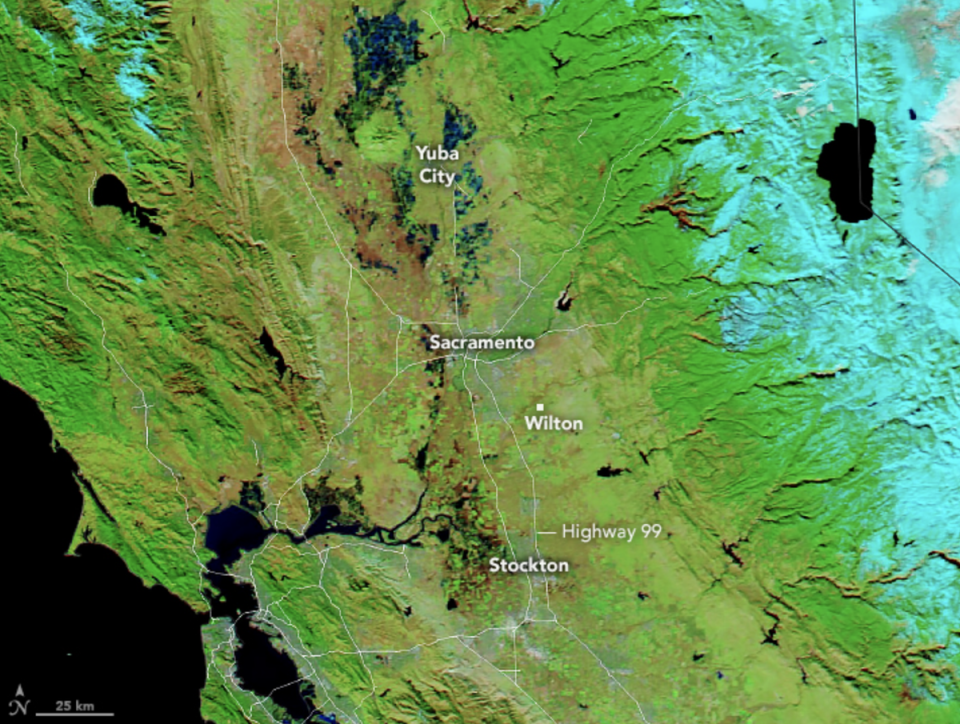
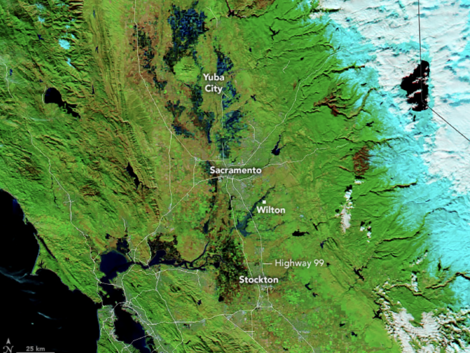
Images captured from space on 1 January 2023 using the Moderate Resolution Imaging Spectroradiometer (MODIS) on NASA’s Aqua satellite revealed how the region quickly became saturated by flooding. An earlier image, captured on 16 December 2022 showed bare and dry land by comparison.
The images showed stark differences in waterways along the busy Golden State Highway close to Yuba City, Sacramento, Wilton and Stockton.
Warnings of excessive rainfall have been issued for millions of people in California again this week. NWS warned of a so-called “Pineapple Express” barrelling in from Hawaii with strong winds in combination with a bomb cyclone that will fuel walls of intense rain and snow squalls.
On Wednesday, the National Weather Service in San Francisco warned of a “potent” atmospheric river impacting the region through today and overnight into Thursday.
An “atmospheric river” - or “river in the sky” - is a band of water vapor that forms over the ocean and can be nearly 400 miles in width.
These weather phenomenon occur globally, but are common on the US West Coast where they drag moisture onshore from the Pacific and account for up to half of annual rainfall. Such extreme weather events are being intensified by the climate crisis.
Here we go again, but this time with lots of wind.#PineappleExpress heading our way for midweek.
Checkout the plume of moisture peeling off the tropics, just NW of the Hawaiian Islands.
Monday/Tuesday are prep days.#cawx pic.twitter.com/F7Q6qbF5K8— NWS Bay Area 🌉 (@NWSBayArea) January 2, 2023
The event will bring substantial rainfall to the San Francisco Bay Area and Central Coast, dropping more water onto already saturated soils and increasing the risk of flash flooding and landslides in steep areas.
In addition strong gusty winds will bring branches and trees down, which may cause localized damming of water ways, NWS warned.

