
Sweeping southern US chill may trigger Florida records, Appalachian snowflakes

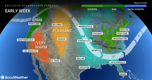

The same massive rainstorm that pivoted from the Midwest to the Northeast over the weekend allowed a push of much cooler air to sweep from west to east across the southern United States, AccuWeather meteorologists say. People who mind cool weather will be trading shorts and t-shirts one day for long sleeves and jackets early week.
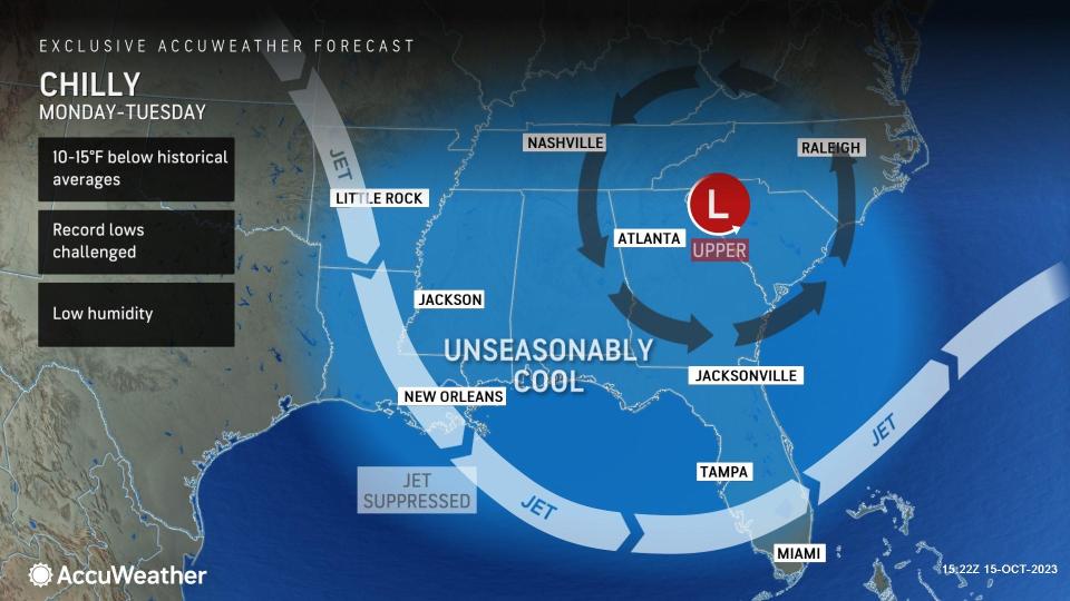
People in the Southeast, especially those in Florida, may be in for quite a shock as temperatures plunge. The first snowflakes of the season may even occur in the higher elevations of the Appalachians.
 |
A much larger and stronger storm system advanced from the Midwest to the Northeast during the weekend. Correspondingly, to the south, a much stronger cold front trailing the storm swept across Florida over the weekend.
"The front brought temperature drops from 10 to 20 degrees as it pushed southward across the region," AccuWeather Senior Meteorologist Bill Deger said.
 |
Highs in Houston over the weekend followed a general downward trend from the upper 70s to the middle 70s, with overnight values expected to dip to their lowest levels since April. The historical average for mid-October in Houston ranges from morning lows in the lower 60s to afternoon highs in the mid-80s. Early this week, the Houston area may experience its chilliest conditions since March as low temperatures dip into the upper 40s.
The transition to much cooler conditions occurred Saturday night around Atlanta. Following a high well into the 70s on Saturday, temperatures plummeted into the 50s Saturday night. Lows in the 40s will be common for the first half of this week, and at times, RealFeel® Temperatures may dip into the 30s at night. Should actual temperatures dip into the mid-40s in Atlanta during the chilly outbreak, they may reach the lowest levels since last April.
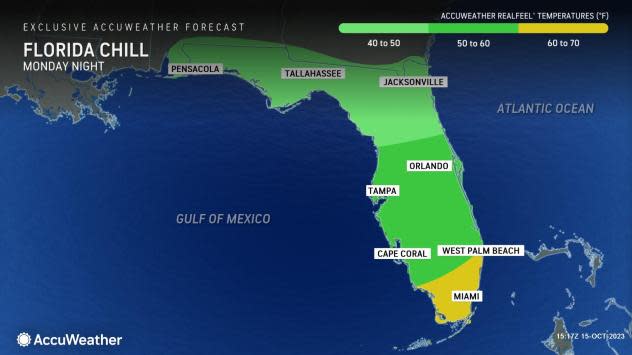
"The change will be most stark across parts of Florida, where a record-warm air mass will be replaced by a record-cool one, especially in the southern part of the peninsula and Keys," Deger said.
After two consecutive new daily record highs on Thursday and Friday at Miami International Airport, high temperatures on Sunday will again challenge records last reached there in 2009.
 |
However, in the wake of the front on Monday and Tuesday, temperatures may top out only near 80 on Monday and Tuesday in Miami. With a breeze and much lower humidity, it may feel more like the mid-70s during the day and the 60s at night. On Monday night, temperatures may dip to within a couple of degrees of 60. The record low Tuesday morning is 59 set in 1977. Should temperatures dip that low, the last time for such an occurrence was in mid-March.
People spending a week at the theme parks around Orlando may need a wide range of attire to handle the changing weather conditions.
Following a high in the upper 80s on Saturday in Orlando, temperatures may be no higher than the mid-70s on Monday. Multiple nights with lows ranging from 55-60 are in store for central Florida early this week, which would rival temperatures not experienced since the middle of April.
A breeze will be quite active over the Southeastern states into the early part of the week. The breeze will prevent frost from forming over the interior but will add to the coolness of the air, especially in the shade during the day and when people are out and about during the evenings.
 |
These gusts can also create choppy conditions on the larger lakes over the interior and locally rough conditions on the Gulf of Mexico and over the coastal Atlantic.
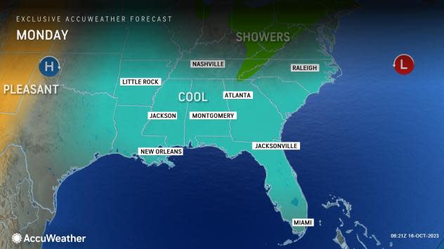
Along with the chill in the Southeast, the air will be quite cold in the upper portion of the atmosphere into Monday. When this setup occurs in the summertime, thunderstorms often erupt. However, at this time of the year, while the setup could also allow some locally drenching showers with thunder, lightning and even small hail, there may also be the first snowflakes of the season over the higher terrain of the southern Appalachians.
Places such as Grandfather Mountain and Mount Mitchell, North Carolina, are most likely to have a bit of snow through Monday, but it is also possible for places like Boone, North Carolina, and Bluefield, West Virginia, to have a few wet snowflakes.
Want next-level safety, ad-free? Unlock advanced, hyperlocal severe weather alerts when you subscribe to Premium+ on the AccuWeather app. AccuWeather Alerts™ are prompted by our expert meteorologists who monitor and analyze dangerous weather risks 24/7 to keep you and your family safer.
