
Travel risky across B.C. as snow, freezing rain hamper major routes
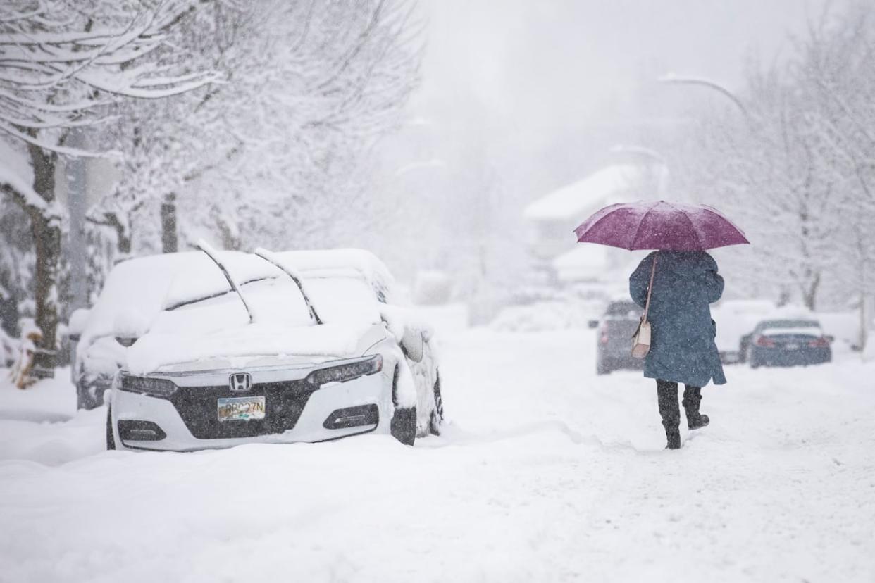
Weather warnings remained in place across British Columbia Friday as a mix of snow and freezing rain in some areas made commutes difficult, despite warming temperatures in many regions.
DriveBC posted a range of travel advisories for Highway 1 through the Fraser Valley, warning that "rapidly deteriorating road conditions and short notice closures" could come into place due to snow and freezing rain in the area, stretching all the way from Langley to Hope and Lytton.
The agency said driving in the corridor is "not recommended unless necessary."
Josh Smythe, a spokesperson for the B.C. Automobile Association (BCAA), urged drivers to use winter tires.
"The freezing rain is going to create black ice that we're not going to be able to see, because it's going to be underneath the surface of the remaining snow," Smythe told CBC News Friday. "In these conditions ... what better traction you get with the proper tires is what's going to keep you on the road."
On Vancouver Island, the province's Ministry of Transportation warned that up to 20 centimetres of snow could fall on the Malahat Highway through Friday morning, and asked commuters to avoid unnecessary travel in coastal B.C.
By Friday afternoon, some of the freezing rain warnings for the Fraser Valley had been lifted, such as those for Abbotsford, but those further east remained in place.
As of 4 p.m., B.C. Hydro had restored electricity to all but roughly 800 out of the 20,000 customers who were without power earlier in the day.
The majority of the remaining outages were on northern Vancouver Island, where nearly 550 customers were affected, as well as more than 100 in North Vancouver.
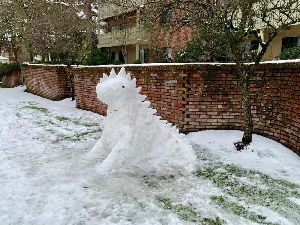
A snow dinosaur is seen in Victoria on Thursday morning. While many schools were open in the provincial capital, they shut early due to a fierce snowstorm. (Kathryn Marlow/CBC)
Snowfall and freezing rain warnings were also in place for Prince George and the Central Interior, as well as the North and Central Coast, with amounts of up to 15 centimetres expected.
Despite the threat of freezing rain for parts of the province, the weather outlook was much improved by Friday afternoon compared to a week ago.
Freezing rain warnings from Environment Canada for areas of the Fraser Canyon, Coquihalla Highway and Highway 3 from Hope to Princeton said snow will transition to freezing rain sometime Friday afternoon.
"For Highway 3 and Manning-Skagit Valley there will be a risk of freezing rain Friday afternoon with more continuous freezing rain expected overnight Friday," reads the warning.
DriveBC said several major Interior routes will be closed to conduct avalanche control work Friday evening, impacting Highway 3 between Salmo and Creston starting at around 4 p.m., and Highway 1 between Revelstoke and Golden at around 11 p.m. .
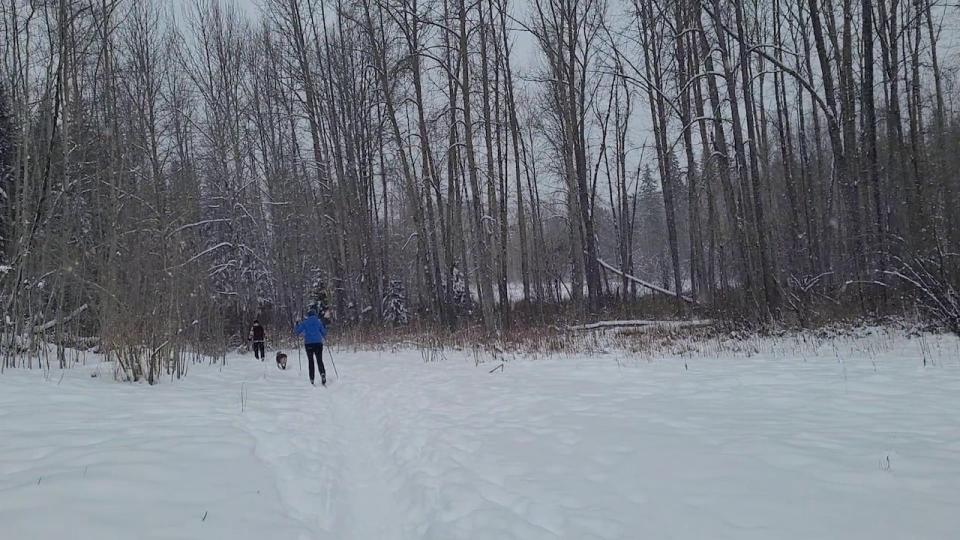
Skiers in Moore's Meadow in Prince George, B.C. on Jan. 19, 2024 as an anticipated 15 centimetres of snow falls. (Andrew Kurjata/CBC)
The province said in a Thursday statement that "freezing rain is one of the most difficult weather conditions to effectively manage, and bridges and roads may be closed to traffic in the interest of public safety."
Environment Canada warns that roads and walkways may become slippery or icy due to the prolonged winter conditions, with up to 30 centimetres of snow having fallen in the Lower Mainland overnight on Wednesday.
Temperatures in the province have rebounded from the deep freeze earlier this month that saw daily record lows in several communities.
The cold snap was followed by a dump of snow that resulted in Vancouver's snowiest day in almost three decades on Wednesday with 28 centimetres recorded, cancelling flights and disrupting everything from mail service to transit.
Avalanche Canada said Friday that backcountry users in southwestern British Columbia should exercise extreme caution as recent snowfall, freezing rain and wind has created "very dangerous" conditions in the mountains along the South Coast and on Vancouver Island.
Schools across the Fraser Valley, from Langley and Maple Ridge-Pitt Meadows through Abbotsford, Mission, Chilliwack and Fraser-Cascade, cancelled classes for a third straight day. On Vancouver Island, the Comox Valley and Campbell River school districts also cancelled classes.
All other school districts in the Lower Mainland reopened classes Friday after two consecutive snow days.

