
UK weather: New thunderstorm warning issued for England and parts of Wales on Sunday as rainy end to Bank Holiday forecast
A weather warning for thunderstorms has been issued for England and parts of Wales on Sunday.
The Met Office yellow warning will be in force from 12pm to 8pm and covers hundreds of miles from Milton Keynes in the south, Norwich in the East, Liverpool in the North West and York in the North.
It also covers Birmingham, Manchester, Hull and Nottingham, as well as areas of northeastern Wales, and could bring between 20mm and 30mm of rain in just a few hours.
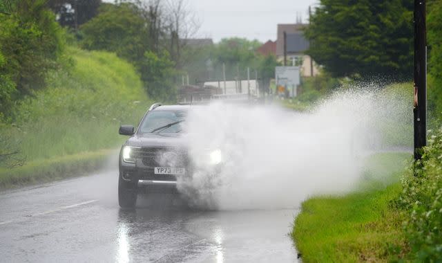
"Slow-moving heavy showers and thunderstorms," will risk difficult driving conditions, homes and businesses being flooded, and lightning strikes, the Met Office said.
This could cause road closures and delays on public transport, the forecaster added.
Disruptive weather could add to weekend of busy travel
The transport network has already been hit by millions taking to the roads over the bank holiday weekend - and planned rail engineering works.
A Network Rail project has reduced services on the West Coast Main Line due to work around Crewe and Carlisle.
Trains are also being affected by track renewals between Carstairs and Lanark in Scotland, with significant changes to services on the Great Eastern Main Line because of work to build a new station at Beaulieu Park to the east of Chelmsford.
The worst travel day of the weekend was Friday, however, when the start of the long weekend coincided with the half-term break for many schools.
Trains were forced to run at reduced speed between Birmingham New Street and Wolverhampton that day after thieves tried to steal signalling cables.
Avanti West Coast, CrossCountry, London Northwestern Railway, Transport for Wales and West Midlands Railway passengers suffered delays until the damaged wires were repaired, Network Rail said.
Aviation analytics company Cirium said Friday was the busiest day of the year for UK airports since October 2019, with more than 3,150 departing flights.
Around 8,486 flights were scheduled to take to the skies between Saturday and Monday, with the most popular destinations for UK departures being Dublin, Amsterdam, Palma, Alicante and Malaga.
Read more from Sky News
Boy, 17, arrested after double beach stabbing
More than 10,000 small boat arrivals this year
Orange cloud after industrial incident
Further showers likely on Bank Holiday Monday
Sky News weather producer Joanna Robinson said of the weekend's conditions: "Rain will turn increasingly patchy on Sunday as it moves northwards, with heavy showers developing from the south. They'll bring the risk of hail and thunder, with localised flooding possible.
"Bank Holiday Monday will bring further showers, some thundery, but western parts will turn drier later on.
"It's worth keeping an eye on the forecast, as short-notice thunderstorm warnings may be issued on Sunday and Monday.
"Daytime temperatures will be around average, but it should feel warm in any sunshine."
Met Office forecaster Craig Snell added: "Overall, it's a pretty mixed picture, Saturday's probably the best of the bunch, but there will still be some sunshine around on Sunday and Monday, but we'll certainly be dodging downpours.
"Watch out for some thunderstorms especially across parts of northern and central England and northeast Wales too."

