
Record rainfall expected for parts of southwestern Ontario on Wednesday
A meteorologist with Environment Canada says she wouldn't be surprised if parts of southwestern Ontario saw record breaking rainfall amounts on Wednesday.
Trudy Kidd said the region and beyond are expected to see significant shower activity as remnants of Hurricane Beryl make their way over Arkansas, across Michigan, and toward areas like Windsor and Sarnia first.
"I think Wednesday morning looks to be the most impactful for extreme weather in southwestern Ontario. That's Windsor. Sarnia, London, Chatham," said Kidd.
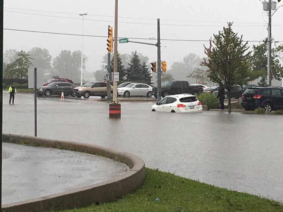
The record flooding in Windsor-Essex in August 2017 flooded more than 6,000 basements in the region. (Chris Ensing/CBC)
"I expect the heaviest rain to be Wednesday morning, but it won't stop raining after that. There's going to be more added to it."
Kidd said the rain is expected to arrive overnight, possibly after midnight.
A rainfall warning for all of southern Ontario was issued on Tuesday afternoon. Environment Canada said the "exact track of the weather system remains somewhat uncertain."
Kidd said she wouldn't be surprised to see rainfall records set with this system.
For context, according to Environment Canada, here are the records for July 10 in Windsor, Chatham, Sarnia and London:
Windsor — 49.8 millimetres in 1974.
Chatham — 35.8 millimetres in 1967.
Sarnia — 50.8 millimetres in 1949.
London — 80 millimetres in 1921.
I won't be surprised tomorrow if someone has received 100 millimetres of rain with this system. - Trudy Kidd, Environment Canada
But Kidd doesn't expect London to be able to surpass its lofty record for that day from over 100 years ago.
The rainfall warning calls for "torrential downpours" with rainfall rates anywhere between 20 to 40 millimetres per hour at times — and localized totals between 40 to 60 millimetres or higher.
"I won't be surprised tomorrow if someone has received 100 millimetres of rain with this system," said Kidd.
"Maybe you get 30 millimetres, but if it falls in two hours in a city centre that could spell trouble in terms of localized flooding, especially over highways, or low lying areas. That's really what we're concerned about here with this system."
The rain is expected to taper off into Wednesday night, said Kidd, but they're expecting around 24 hours of showers.
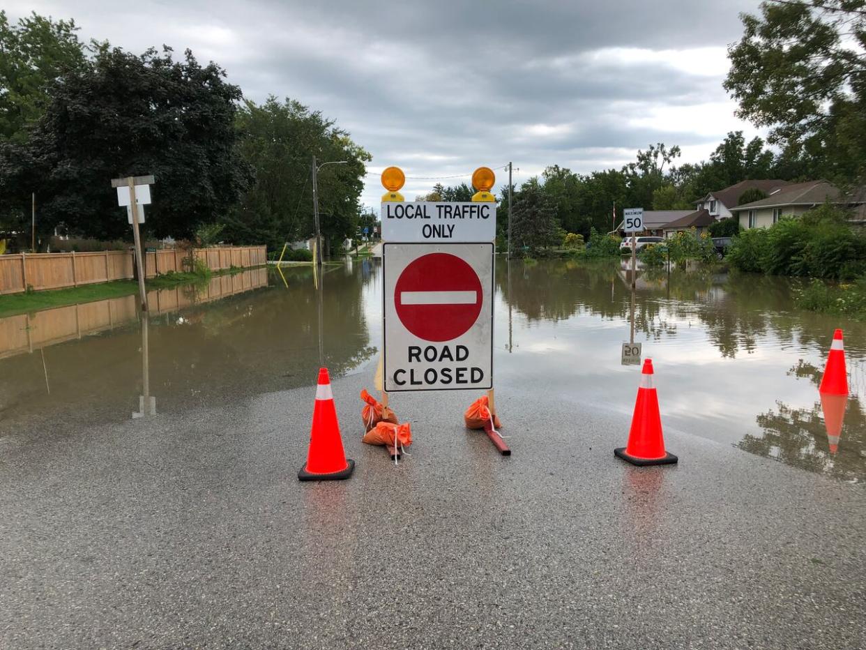
Essex Region Conservation Authority has warned there could be ponding and water spilling over banks in some low-lying areas. This could be dangerous for anglers, canoeists, hikers, children and pets.
The emergency measures co-ordinator for Essex County said he's been tracking the storm since it first made the news — and that he takes its remnants across southwestern Ontario seriously.
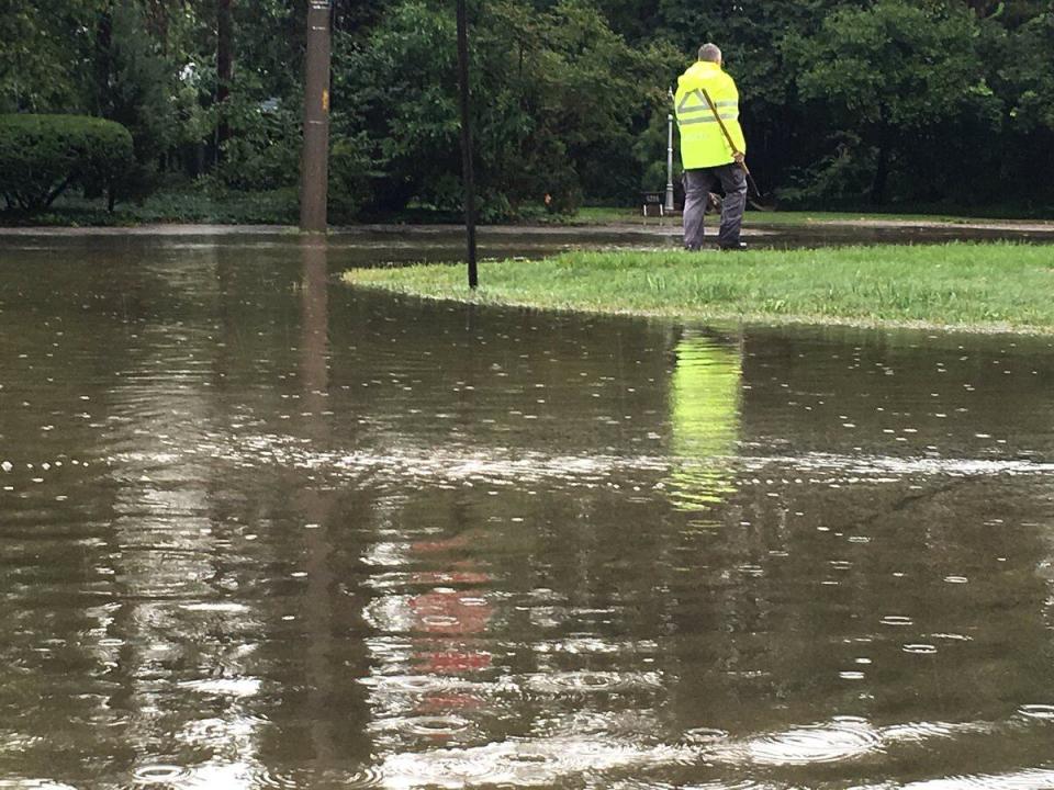
A man is shown standing atop a green space beside a flooded area in the Windsor region in 2016. (CBC)
Dan Metcalfe said although projections of its severity are difficult to make, he's well aware of potential flash flooding due to significant rainfall in a short period of time.
"We're not sure exactly how it's going to go, but this has been a trend over the past decade, with particular storms that hit our area and 100-year floods that we had in 2016, 2017 and also last year in 2023 for Harrow, Colchester, Kingsville area," he said.
According to Metcalfe, low-lying areas are normally the greatest concern for flooding during rainfall events like this — which points to the southernmost belt of the county.
"Historically the low-lying areas along the coastlines … areas down by the river in Windsor on the east side. And and particularly in the south, in the Harrow, Colchester area. And all along the coastlines we know that they're former marshlands. It's lower elevation."
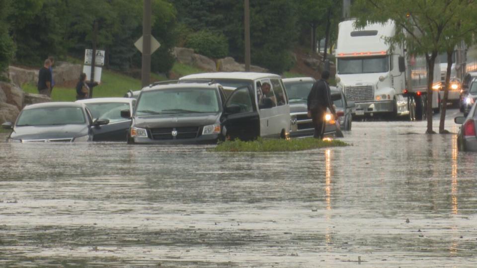
A vehicle is stuck on a flooded street near the Tecumseh Mall during a recent storm event. (Stacey Janzer/CBC)
Windsor's head engineer said the city has improved its infrastructure with trunk sewers and retention ponds ever since major flooding events eight years ago.
Mark Winterton also said lower lake and river levels this year should help during rain events.
"When we've had some previous ones, we had a high water level, and so the water didn't drain out as fast."
However, in the short term, he said, there's little that can be done by a municipality when a storm is on its way.
But homeowners can help out their own cause, he added.
"Look at the downspouts, make sure that they're clear and running freely. Their gutters, troughs are cleaned out, and are away from the home."
Winterton said drivers also need to be aware and understand not to go into water where you can't see the road.
"You never know how deep these … can be and you can get yourself stranded. We've seen that historically caused some problems."

