
Winter arrives with snow, ice and wind for parts of N.S. on Thursday

Winter will arrive with a blast of snow, ice and strong winds on Thursday, continuing into Friday across eastern Nova Scotia and Cape Breton.
In the short term, rounds of rain will continue to move over eastern areas, with additional precipitation of 40 to 80 millimetres possible through Wednesday and Wednesday night.
By Thursday morning, the total amount of rain from the storm blowing since Monday will likely climb into the 100-150 millimetre range for many areas, especially in Victoria County where localized amounts over 200 millimetres are possible.
Winter officially arrives late Thursday evening, however wintry conditions will arrive a bit early.
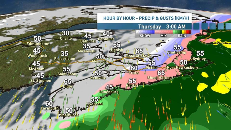
As strong northerly winds begin to wrap colder air into our system Wednesday night and into Thursday morning, we will start to see the rain change over to an icy mix of ice pellets and freezing rain.
This will likely lead to some slick travel conditions for the Thursday morning commute across central and eastern areas of Nova Scotia.
(Ryan Snoddon/CBC)
(Ryan Snoddon/CBC)
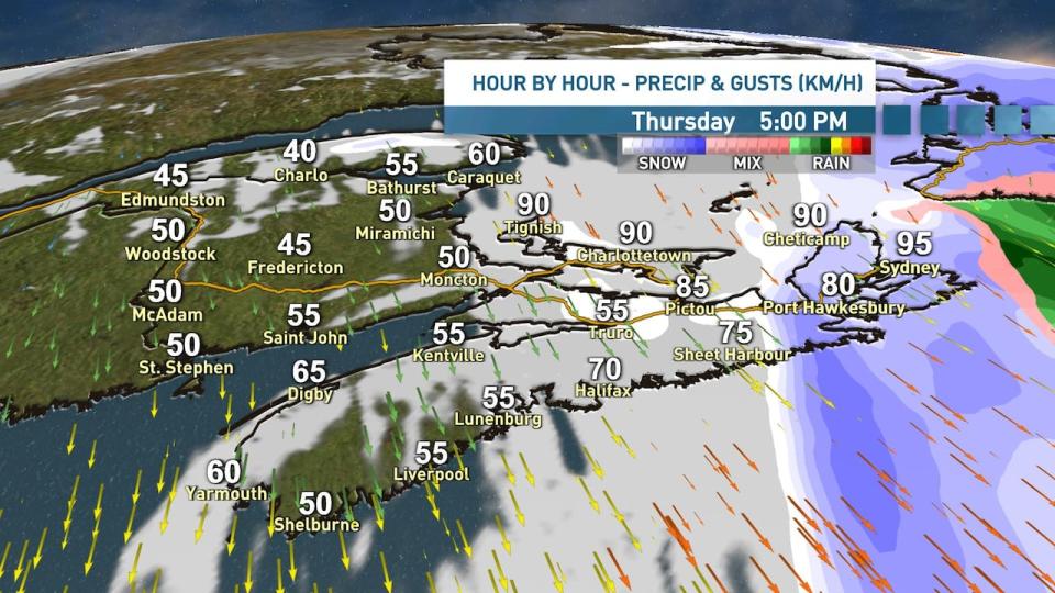
That icy mix will then change over to snow from west to east, beginning overnight along the Northumberland Shore, but not until midday Thursday for the Sydney area.
Once the transition to snow has occurred, blowing snow will immediately become an issue.
Widespread wind gusts of 70 to 90 km/h are predicted, leading to blizzard-like conditions beginning Thursday afternoon, continuing overnight and through Friday, especially in open and exposed areas.
Environment Canada wind and rainfall warnings
Environment Canada issued wind and rainfall warnings on Wednesday for Antigonish County, Guysborough County, Inverness County-Mabou, Pictou County, Richmond County, Sydney Metro and Cape Breton County and Victoria County.
In its warning, the department said it expects to see wind gusts around 90 km/h, with damage and power outages expected. The forecast anticipates high winds will begin Thursday morning and persist into the evening.
The rainfall warning, which also applies to Halifax County east of Porters Lake, could mean as much as 70 millimetres by Thursday morning. It noted similar storms in the past have caused water damage to property and infrastructure, fast-flowing water spilling over river banks as well as washouts and road closures.
(Ryan Snoddon/CBC)
(Ryan Snoddon/CBC)
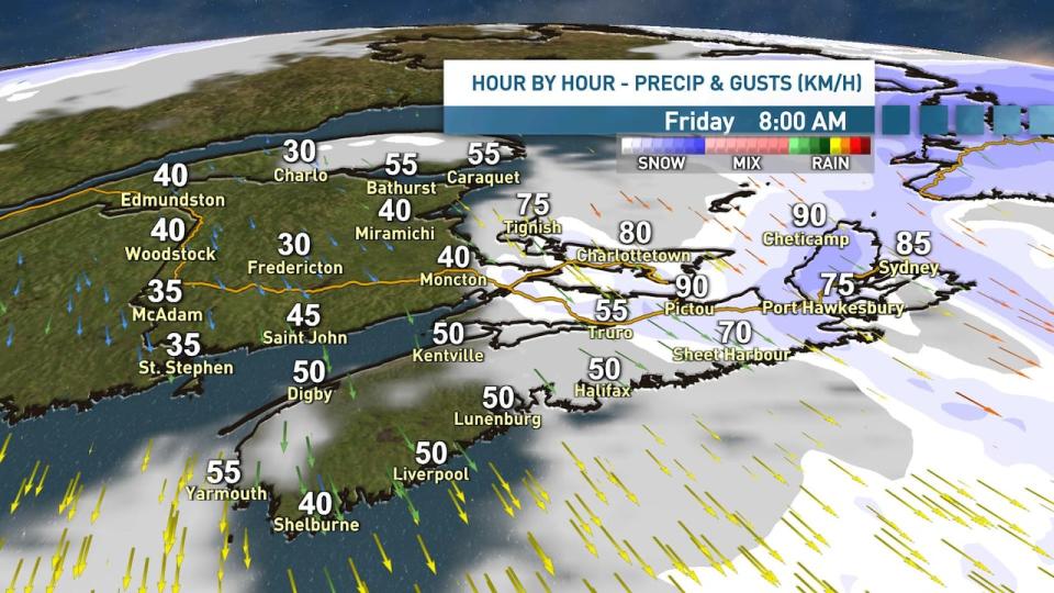
Folks traveling should prepare for possible whiteouts and hazardous travel conditions.
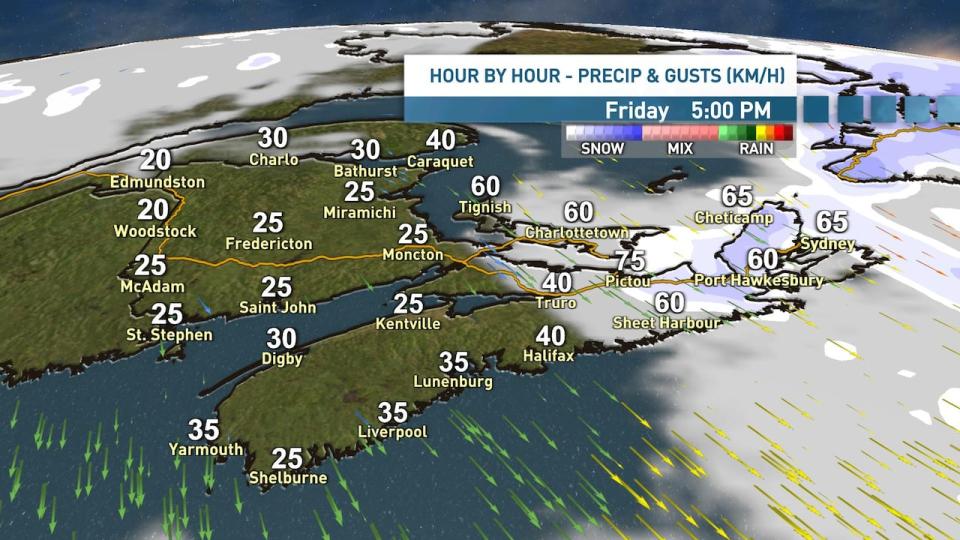
The snow is expected to taper off to flurries from west to east throughout Friday afternoon and Friday evening, however blowing snow will remain an issue until the winds slowly subside Friday night.
By the time we get to Friday evening, eastern areas of the Northumberland Shore and Cape Breton can expect to see 10 to 20 centimetres of snow, with higher amounts of 20 to 30 centimetres possible for Inverness and Victoria county, especially over higher terrain.
The good news is, an area of high pressure will move into the region this weekend and folks hoping to travel will enjoy quiet conditions from Saturday through Boxing Day.
MORE TOP STORIES

