
Winter storm to bring travel trouble, over a foot of snow to the Rockies
A part of the atmospheric river that has been blasting the Pacific Northwest with heavy precipitation to begin the month broke off and moved to the Rocky Mountains to end the week, bringing snow that will be both a boon to ski resorts and a headache for travelers, say AccuWeather meteorologists.
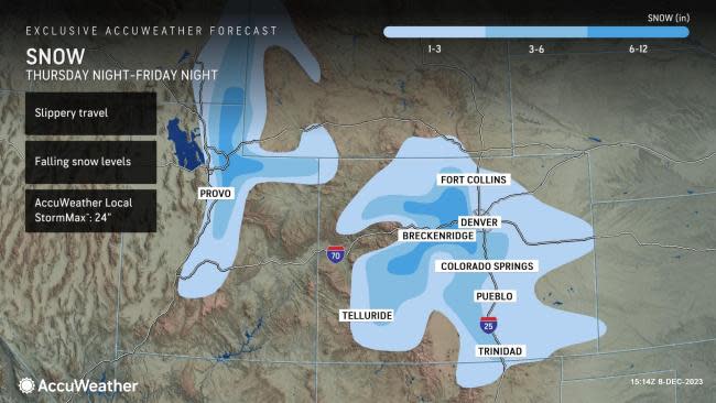
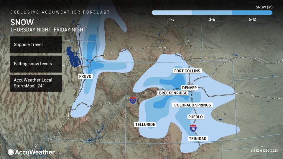
The storm, while not significant by Rockies standards, has dropped several inches of snow, especially along and near the Wasatch Range in Utah and the Rockies in Colorado. Travel in and around cities such as Denver and Salt Lake City can be impacted.
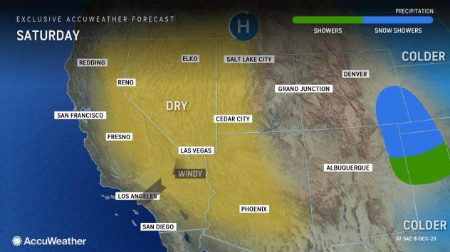
Accompanying the snow will be plummeting temperatures, which can produce icy spots, especially on bridges and overpasses. Temperatures will end up falling by about 40 degrees from Thursday to Saturday, warned AccuWeather Meteorologist Haley Taylor.
The evening commute on Friday can be impacted by the snow along the Interstate 15 corridor between Provo and Salt Lake City in Utah, and the evening drive could be slowed along Interstate 25 from Pueblo to Denver to Fort Collins in Colorado.
Any amounts above 3 inches will be reserved for the higher elevations, including the Wasatch and Rockies, where more than a foot can fall, as well as the Palmer Divide. The AccuWeather Local StormMax™ for snow is 24 inches.
"The highest snowfall totals will be found in the higher elevations, where driving conditions can become poor rapidly," added Taylor. This includes travel for those headed through the mountains, including Vail Pass along Interstate 70 west of Denver and Interstates 80 and 84, east of Salt Lake City.
With strong winds also expected in the mountains, visibility can drop to near zero at times due to blowing snow. AccuWeather RealFeel® Temperatures could be as low as 15 degrees below zero. People planning to pass through the mountains during the storm may want to consider delaying travel or using snow chains on their vehicle's tires.
In typical Denver fashion, the mercury will tumble from the 60s on Thursday morning to the teens by Saturday morning. The historical average for this time of year is right in the middle, in the mid-40s for an afternoon high temperature.
 |
While the snow will cause issues for travelers, it will be welcomed by ski resorts eager to open up more trails.
According to OnTheSnow.com, just 13 to 17 percent of trails are open at Colorado's four biggest ski resorts-Aspen Snowmass, Vail, Breckenridge and Steamboat-with base snow depth at the resorts ranging from 19 to 36 inches. In Utah, where snow has been in even shorter supply since the beginning of the winter, just 6 and 8 percent of trails were open at Park City and Snowbird resorts.
With the prospects of a foot or more of fresh powder at these ski resorts through late week, outdoor winter enthusiasts will no doubt be taking out their skis and snowboards for some fun in the snow this weekend.
Want next-level safety, ad-free? Unlock advanced, hyperlocal severe weather alerts when you subscribe to Premium+ on the AccuWeather app. AccuWeather Alerts™ are prompted by our expert meteorologists who monitor and analyze dangerous weather risks 24/7 to keep you and your family safer.
