
I hiked 5 miles along the California coast to test AllTrail’s ‘biggest update yet’ — 5 features that stood out the most
As an avid hiker fortunate to live in the U.S. Pacific Northwest, a location with no shortage of accessible trails, the AllTrails app has long been part of my pre-trek research. It features details on 400,000+ treks with the most crucial information available free of charge.
The size of the AllTrail's database, its complimentary nature and all-around friendly user interface make it an indispensable tool not just for hikers but mountain bikers and trail runners, too, helping it sit neatly alongside the best workout apps.
I've admittedly only ever used the free version, that is, up until last week when I got the chance to join AllTrails in Sonoma, California for a few days of hiking. There, I got to test out what CEO Ron Schneidermann describes as the app's 'biggest update ever.'
For reference, AllTrails launched in 2010, and indeed, this update is significant. Throughout my five-mile trek along the scenic coastline, I got to check out new and improved trail and park pages, interactive elevation tools, dynamic photo galleries, reimagined safety features and much more.
Beginning with those accessible for free, these are the latest AllTrails features that stood out to me most on my recent outdoor adventure.
1. New hike and park pages
Part of AllTrail's latest update includes redesigned trail pages and new park guides which are available to all users running the freshest version of the app.
Starting with trails, the most important information has been moved to the top of the page for quick access. This includes trail length, elevation gain, completion time estimates, difficulty rating and whether it's an out-and-back or a loop-style trail.
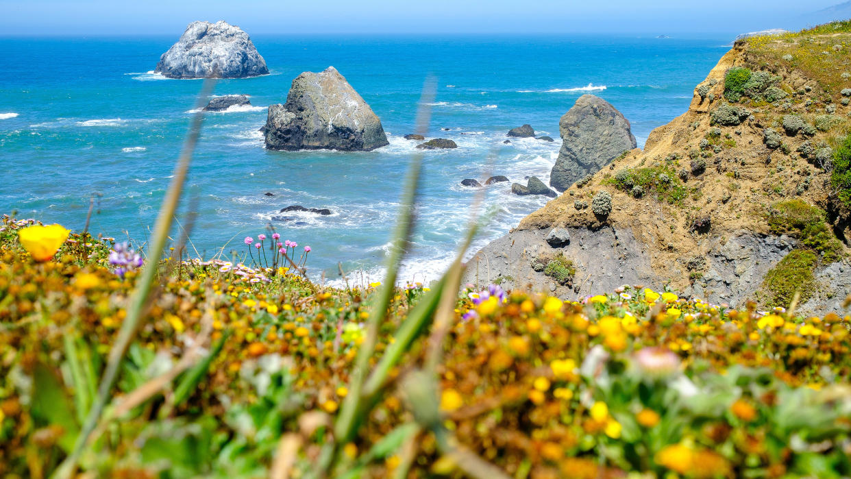
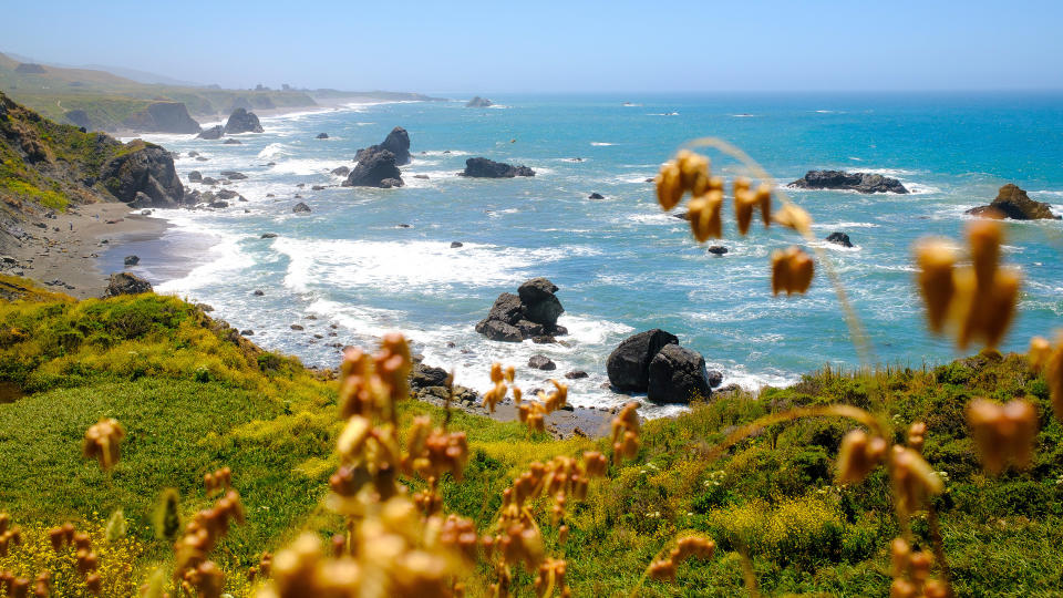
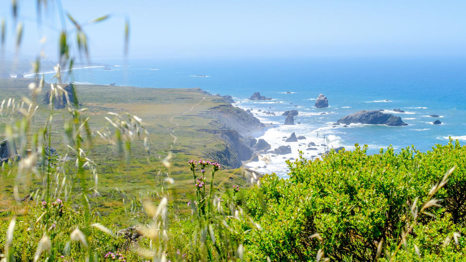
With a last-minute change to our hiking itinerary due to a heat advisory, I was able to quickly download and inspect our replacement hike — Kortum Trail in Jenner, California — to get the key details in a matter of seconds as the crew loaded onto buses for departure to the trailhead.
In addition to easier-to-parce trail pages, AllTrails has launched new park guides. As of publishing, these cover U.S. National Parks, state and local parks as well as a selection of international parks.

Kortum Trail happens to be part of Sonoma Coast State Park, and a quick trip to its refreshed page reveals a total of 34 hikes, including those that are dog and/or kid-friendly.
Important park info is also right up front, like total acres, hours, fees, accessibility, current closures and alerts. You also get recommendations for popular trails and suggestions for epic spots to check out.
National Park pages also include new detailed visitor guides with history, park facts and in-depth recommendations for visitors. Plus, you can sort hikes via 'collections' which include: dog-friendly, kid-friendly, among trees, epic views, rivers, lakes, wildflowers, top picks and hidden gems.
I've yet to try out this new sorting method but as someone who suffers greatly from choice overload, I appreciate any tools that can help whittle down my selection of treks.
2. Dynamic seasonal photo galleries
Photo galleries have been seriously overhauled within the AllTrails app for all users. Galleries for hikes now prioritize recently shot images to better convey current trail conditions. The galleries are also dynamic, constantly updating as users upload new shots from the trail.
With more than 60 million photos uploaded to AllTrails in total, selecting those that best represent a hike is no easy task, which is why the company uses machine learning to choose the top shots based on a variety of factors like pixel density, exposure, saturation and location.
The process also includes AI-backed subject recognition to identify things like flowers, waterfalls, beaches, etc. These variables also help inform the new Collections feature.
Dynamic photo galleries are accessible to all and should go a long way to helping users better visualize what their upcoming trek will look like. Better yet, you can also now view trail photos based on the season. This is particularly useful if you're planning a hike well in advance.
3. Interactive elevation timelines
Building on the improved photo gallery experience, AllTrail's interactive elevation timelines, easily my favorite new feature, are also available to all users. You can find the scrubbable timeline from within the updated trail gallery view which lets you view photos taken from virtually any point along the route.
One premium feature that isn't necessarily brand-new but still cool is the 3D hike preview that takes you through your planned trek via a satellite map. During the visualization, users can easily zoom in and out on areas of interest as they please.

4. Live share for safety
Back in February AllTrails relaunched its Lifeline safety feature to make it easier to use. Now called Live Share, this tool, available to paid users, lets you generate a link with details about your planned route, expected finish time and real-time location before a hike and share it with friends or family members.
It's always a good idea to tell someone your outdoor adventure plans before departing, even if you're going out with a group of people. While I didn't remember to use Live Share while trekking the California coast, I did test it out on a recent urban hike in Seattle and found it incredibly straightforward. So much so, that I plan to incorporate the tool into my standard pre-hike protocol from here on out.
5. Advanced condition reports
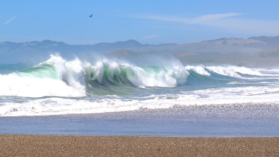
Lastly, Advanced Condition Reports, which also debuted in February, are for premium users and build upon the app's already free Trail Weather Reports. With trail conditions frequently in flux during the spring and fall months, ACRs clue users into current ground conditions, various weather conditions along the trail — which is particularly useful for those with a lot of elevation gain — and mosquito activity.
For our trek along the coast, the latter proved highly useful as the flying, buzzing bloodsuckers were out in full force. Fortunately, the kind folks at AllTrails came prepared with plenty of insect repellent.

