
Woman killed by Storm Doris 'weather bomb' as gusts hit 100mph and blizzard-like snow batters Britain


Port of Liverpool shut due to 100mph gusts
36 flights at Heathrow cancelled
Speed restrictions across rail network
Scotland warned of blizzard-like conditions
Outdoor filming of Coronation Street halted
Game of Thrones scene damaged
Naming storms 'has made Britain safer'
Met Office issues ice warning for Friday
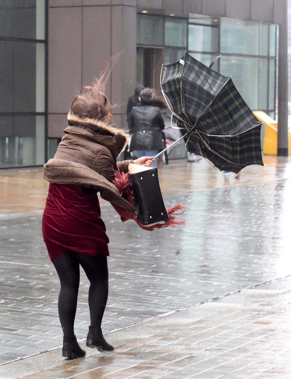
A woman has been killed in Wolverhampton by a Storm Doris as high winds batter the country.
She was confirmed dead at the scene outside a branch of Starbucks after suffering from "very serious head injuries", West Midlands Ambulance Service said.
West Midlands Police said officers were called to a "serious incident" at around 11.50am.
A spokeswoman added: "Roads in the area are closed and motorists and pedestrians are being advised to avoid the city centre. The incident is believed to be related to Storm Doris," she said.
IMPORTANT NOTICE: The Port of Liverpool is closed. pic.twitter.com/DiPA6n2u3c
— Peel Ports (@PeelPorts) February 23, 2017
The Met Office has declared Storm Doris is now a "weather bomb" after an intense drop in pressure saw the Port of Liverpool report winds reaching 100mph, on Thursday.
The port said it had to shut along with the city's waterfront as high winds hit the north-west after Doris made landfall in the UK this morning.
The company said: "All operations are stood down for the safety of our employees, contractors and customers of the port."
In Manchester, outdoor filming for the soap Coronation Street was brought to a halt on the cobbled set.
A spokeswoman for the ITV soap said filming would be rescheduled.
Flights at Heathrow Airport were also cancelled and commuters across the country left facing major disruption.
Meanwhile, there has been flooding, power cuts and trees felled by the high winds. Parts of Scotland have been warned to expect blizzard-like conditions.
The Met Office has also issued a yellow severe weather warning for ice, meaning it has the potential to cause danger to life or widespread disruption.
It covers Scotland, Northern Ireland and the north-east and north-west of England tomorrow.
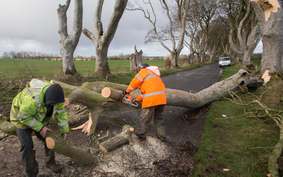
Winter comes to Game Of Thrones scene
In Co Antrim, landmark tree-lined avenue made famous by fantasy drama Game Of Thrones has been damaged in the storm.
One of the beech trees that make up the spectacular Dark Hedges, featured in Season Two of the award-winning TV drama, has fallen victim to high winds that have battered Northern Ireland.
The avenue is one the region's top tourist attractions, with Game of Thrones fans from all over the world travelling to the isolated location to get a picture in front of the haunting backdrop.
The Met Office said storm, upgraded to an Explosive Cyclogenisis, or weather bomb, is likely to damage buildings and send debris flying on Thursday.
Storm Doris hits UK: in pictures
What is a 'weather bomb'?
An Explosive Cyclogenisis is when a storm quickly intensifies and pressure rapidly drops in the centre.
The measure is by 24millibars in a 24-hour period, and it causes very severe weather.
#StormDoris has rapidly deepened over the last 24 hours as it has under gone what we call Explosive Cyclogenisis making it a #WeatherBombpic.twitter.com/U7VI7WDGtT
— Met Office (@metoffice) February 23, 2017
As Doris made its way east, a 94mph gust recorded at Capel Curig in Conwy, north-west Wales, this morning before the Port of Liverpool said 100mph was recorded in Liverpool.
It followed an 87mph gust recorded in the early hours at Mace Head on the Galway coast in the Republic of Ireland.
In Kent, parts of the scaffolding encasing Ashford Police Station has been dislodged by high winds. The main entrance to the station has been temporarily closed by safety fears.
There were power cuts to more than 150 homes on Anglesey in North Wales after cables were blown down, and isolated flooding in some areas of Wales.
A Scottish Power spokesman said: "We're starting to see some faults in small pockets of Gwynedd and north Wales."
Several bridges have been closed causing travel nightmares for commuters today, including the busy QEII crossing in Kent and the Britannia Bridge which links Anglesey to mainland Wales.
Met Office meteorologist Mark Wilson said: "Winds are really starting to pick up now, mainly across western parts of the country."
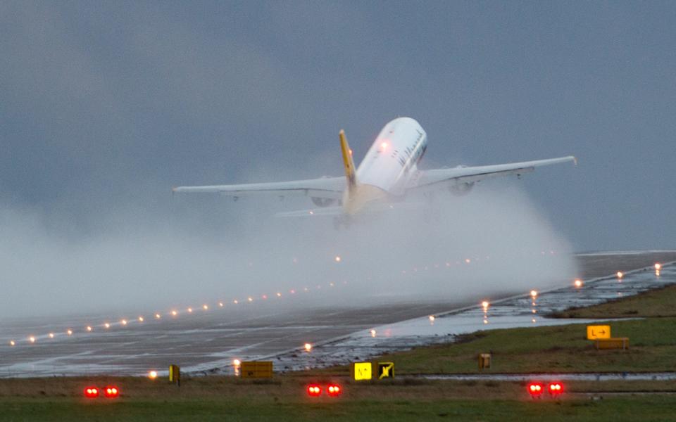
Flight chaos
Aer Lingus cancelled 12 flights between the UK and the Republic of Ireland in anticipation of the winds while 36 flights out of London Heathrow were cancelled and another five at London City with other delays possible.
Strong winds forecast today are expected to cause some delays and cancellations. Please check your flight status: https://t.co/zOqJyQR48T
— Heathrow Airport (@HeathrowAirport) February 23, 2017
A Heathrow spokesman said: "Strong winds and poor weather across the UK have resulted in approximately a 10 per cent reduction to Heathrow's flight schedule.
"With Heathrow operating at more than 99 per cent capacity, there are no gaps in the schedule that can be used for delayed flights and as a result, some passengers may experience disruption to their journeys today."
Explosive deepening of #stormdoris over Ireland ongoing right now. pic.twitter.com/z1y115xHWK
— Anthony Sagliani (@anthonywx) February 23, 2017
Trains cancelled
Trains already being affected on Merseyside by Storm Doris while Network Rail has imposed speed restrictions on several lines around the country.
Network Rail warned of delays and cancellations after imposing speed restrictions for safety reasons.
St Pancras deserted as all trains cancelled #stormdorispic.twitter.com/92VtCuj43B
— Anna Soubry MP (@Anna_Soubry) February 23, 2017
Several Thameslink services into St Pancras have been disrupted due to overhead wires being blown down in St Albans.
Limits of 50mph would be observed on some services run by Southeastern, Arriva Trains Wales, Chiltern Railways, Grand Central, TransPennine Express and Virgin Trains East Coast.
Southern bosses, Govia Thameslink Railway, warned customers that this could lead to delays and cancellations on Southern services and the Gatwick Express.
CANCELLED: Due to poor weather conditions 09:32 #LiverpoolLimeStreet to #WiganNorthWestern due 10:22 will be cancelled.
— Northern (@northernassist) February 23, 2017
Danger on the roads
Highways England has also issued a weather alert on major roads.
Chaos on the M80 which is one of Scotland's busiest motorways. Completely closed just now with commuters stranded. #snow#StormDorispic.twitter.com/blATqj7bHZ
— Connor Gillies (@ConnorGillies) February 23, 2017
Particularly at risk are high-sided vehicles, caravans and motorbikes and drivers are "strongly advised" to avoid travelling on some stretches of road in Yorkshire, the Midlands, and the East and North West.
Richard Leonard, head of road safety at Highways England, said: "We're expecting Storm Doris to have a significant impact on the roads throughout the day so are urging drivers to consider changing their plans if necessary and to slow down in stormy weather.
"Drivers should look out for warnings on the electronic message signs and listen for updates in radio travel bulletins."
Amber warnings predict strong winds and heavy rain in parts of north Wales, the Midlands, and the East and North West, while winds as fast as 60mph are also expected to batter southern England.
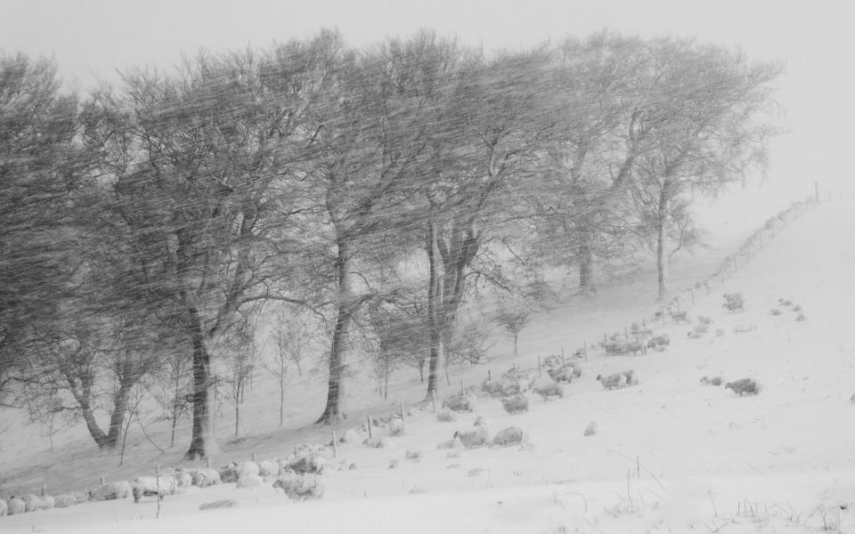
Blizzard-like conditions
Meanwhile, up to 15cm of snow could fall across parts of Scotland and north-east England in treacherous, blizzard-like conditions.
Weather warnings have been upgraded to amber across Scotland's central belt, the Borders, Dumfries and Galloway, Tayside and Fife.
Take care in the snow today. #StormDorispic.twitter.com/zj7kMjV7MR
— Clarence House (@ClarenceHouse) February 23, 2017
"We have got a fairly active area of low pressure coming in from the Atlantic," said Met Office forecaster Emma Sharples.
"It is strengthening as it moves eastwards to the UK."
The Met Office's amber weather warning alerts people that "whilst the strongest winds look to be only short-lived, damage to structures, interruptions to power supplies and widespread disruption to travel networks are likely, with a danger of injury from flying debris".
Storm Doris is expected to move on quickly, with the worst of the weather gone by Thursday evening.
While further Atlantic gusts will bring more rain and wind through the weekend and into next week, they are not expected to reach the heights of Doris.
AA spokesman John Snowling said: "The unpleasant combination of torrential rain, severe gales and heavy snow will create some very poor driving conditions, with the potential for roads to be affected by black ice, debris or standing water.
"Wind can also bring down tree branches, blow you off course or blow other vehicles into your path.
"Expect travel disruption as some roads will be treacherous."
Anyone affected by power cuts during the storm is encouraged to dial 105 for further information.
Storm Doris's appearance contrasts with Monday's temperatures, where visitors to Kew Gardens, west London, enjoyed the warmest day of the winter so far, at 18.3C (64.9F).
Parts of London and the South had temperatures warmer than Ibiza, southern Spain and Menorca.
Storm Doris: The expert analysis
Dr Steven Godby, an expert on natural hazards at Nottingham Trent University, said: “The last storm comparable to Doris caused widespread disruption across the country on January 3, 2012, with the worst affected area being the central belt of Scotland where winds gusted at well over 80mph.
"That storm tracked across the north of Scotland, but the centre of Doris is passing over the north of England, bringing its core of strong winds further south to affect the Midlands across to the Wash.
"These areas are under an amber (be prepared) warning from the Met Office with gales of 50-60 mph widely and gusts of 80mph+ possible.
"These wind speeds bring the risk of structural damage to property, falling trees and branches, interruptions to power supplies and dangerous driving conditions with restrictions on bridges to high-sided vehicles likely.
"Heavy snow will also be a hazard in southern Scotland and parts of northern England for a time as well.
"People should listen to the latest forecast and follow the advice being issued by the authorities, particularly before they travel – the reason these types of storms are now named by the Met Office is to help make warnings more effective."
